
 Litoral Del Bajo San Juan
El Cantón de San Pablo
Juan Frío
Santa Barbara
El Juncal
Dibulla
Vereda Campo Alegre
San Pablo
Guaramito
Litoral Del Bajo San Juan
El Cantón de San Pablo
Juan Frío
Santa Barbara
El Juncal
Dibulla
Vereda Campo Alegre
San Pablo
Guaramito
Playa del Morro on the map, Tumaco, Colombia
Photo
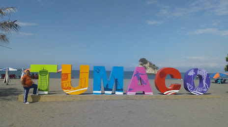
Where is located Playa del Morro
Playa del Morro — local attraction, which is located at no data and belongs to the category — -. Average visitor rating for this place — 4.5 (according to 3040 ratings, information from open sources and relevant for 2022).
Exact location — Playa del Morro, marked on the map with a red marker.
You can get directions to Playa del Morro on the map from your location.
What else is interesting in Tumaco? You can see all the sights if you go to the city page.
Coordinates
Playa del Morro, Colombia coordinates in decimal format: latitude — 1.8296763734733683, longitude — -78.7332804564034. When converted to degrees, minutes, seconds Playa del Morro has the following coordinates: 1°49′46.83 north latitude and -78°43′59.81 east longitude.
Nearby cities
The largest cities that are located nearby:
- Ibarra
 (Ecuador) — 175 km
 - Pasto — 180 km
- Quito (Ecuador) — 222 km
- Santo Domingo (Ecuador) — 231 km
- Popayán — 253 km
- Buenaventura — 299 km
- Cali — 311 km
- Quevedo (Ecuador) — 320 km
- Palmira — 336 km
- Ambato (Ecuador) — 337 km
- Florencia — 353 km
- Buga — 361 km
- Portoviejo (Ecuador) — 365 km
- Manta (Ecuador) — 372 km
- Tuluá — 383 km
- Riobamba (Ecuador) — 383 km
- Neiva — 407 km
- Milagro (Ecuador) — 444 km
- Cartago — 456 km
Distance to the capital
Distance to the capital (Bogota) is about — 602 km.