
 Belém
Maranguape
Paranaguá
Paranaguá
Monte Alegre
Alvorada de Minas
Bragança
Laguna
Ibiporã
Belém
Maranguape
Paranaguá
Paranaguá
Monte Alegre
Alvorada de Minas
Bragança
Laguna
Ibiporã
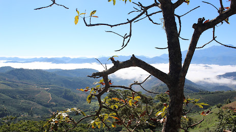
Parque Natural Municipal do Sagui da Serra on the map, Manhumirim, Brazil
Photo
Where is located Parque Natural Municipal do Sagui da Serra
Parque Natural Municipal do Sagui da Serra — local attraction, which is located at Manhumirim - State of Minas Gerais, 36970-000, Brazil and belongs to the category — scenic spot. Average visitor rating for this place — 4.4 (according to 37 ratings, information from open sources and relevant for 2022).
Exact location — Parque Natural Municipal do Sagui da Serra, marked on the map with a red marker.
You can get directions to Parque Natural Municipal do Sagui da Serra on the map from your location.
What else is interesting in Manhumirim? You can see all the sights if you go to the city page.
Coordinates
Parque Natural Municipal do Sagui da Serra, Brazil coordinates in decimal format: latitude — -20.356344650933238, longitude — -42.0118608755291. When converted to degrees, minutes, seconds Parque Natural Municipal do Sagui da Serra has the following coordinates: -20°21′22.84 north latitude and -42°0′42.7 east longitude.
Nearby cities
The largest cities that are located nearby:
- Cachoeiro de Itapemirim — 102 km
- Coronel Fabriciano — 116 km
- Guarapari — 155 km
- Cariacica — 160 km
- Colatina — 163 km
- Valadares Governor — 166 km
- Vila Velha — 172 km
- Serra — 173 km
- Sabará — 201 km
- Barbacena — 210 km
- Juiz de Fora — 210 km
- Belo Horizonte — 211 km
- Santa Luzia — 216 km
- Ibirité — 221 km
- Linhares — 224 km
- Macaé — 224 km
- Contagem — 226 km
- Ribeirão das Neves — 231 km
- Betim — 237 km