
 Belém
Maranguape
Paranaguá
Paranaguá
Monte Alegre
Alvorada de Minas
Bragança
Laguna
Ibiporã
Belém
Maranguape
Paranaguá
Paranaguá
Monte Alegre
Alvorada de Minas
Bragança
Laguna
Ibiporã
Praia Peito de Moça on the map, Luís Correia, Brazil
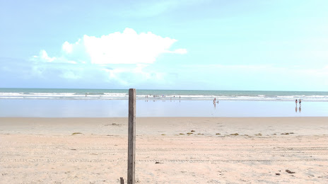
Photo
Where is located Praia Peito de Moça
Praia Peito de Moça — local attraction, which is located at Pr Dunas, Luís Correia - State of Piauí, 64220-000, Brazil and belongs to the category — tourist attraction. Average visitor rating for this place — 4.5 (according to 323 ratings, information from open sources and relevant for 2022).
Exact location — Praia Peito de Moça, marked on the map with a red marker.
You can get directions to Praia Peito de Moça on the map from your location.
What else is interesting in Luís Correia? You can see all the sights if you go to the city page.
Coordinates
Praia Peito de Moça, Brazil coordinates in decimal format: latitude — -2.8989009275166246, longitude — -41.61393640676382. When converted to degrees, minutes, seconds Praia Peito de Moça has the following coordinates: -2°53′56.04 north latitude and -41°36′50.17 east longitude.
Nearby cities
The largest cities that are located nearby:
- Parnaíba — 12 km
- Teresina — 274 km
- Timon — 276 km
- Caxias — 288 km
- São Luís — 292 km
- Caucaia — 344 km
- Maracanaú — 352 km
- Fortaleza — 359 km
- Mossoro — 539 km
- Juazeiro do Norte — 545 km
- Imperatriz — 702 km
- Castanhal — 713 km
- Petrolina — 730 km
- Ananindeua — 760 km
- Belém — 771 km
- Parnamirim — 779 km
- Natal — 780 km
- Campina Grande — 796 km
- Araguaína — 861 km