
 Sanavardo
Undilaantkari
Toncha
Pkhundavi
Tiseli
Ukeshi
Maisauri
Ghogheti
Matsevani
Sanavardo
Undilaantkari
Toncha
Pkhundavi
Tiseli
Ukeshi
Maisauri
Ghogheti
Matsevani
Synagogue on the map, Kutaisi, Georgia
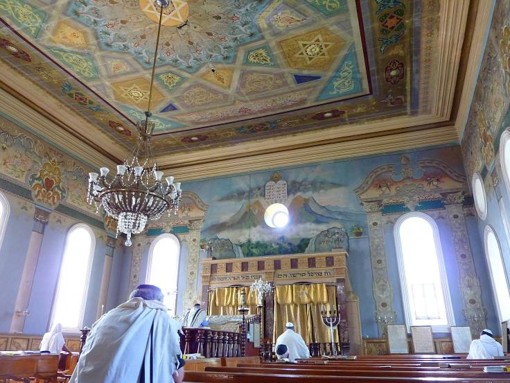
Photo
Where is located Synagogue
Synagogue — local attraction, which is located at Boris Gaponov Street, Kutaisi, Georgia and belongs to the category — synagogue. Average visitor rating for this place — 4.6 (according to 262 ratings, information from open sources and relevant for 2022).
Exact location — Synagogue, marked on the map with a red marker.
You can get directions to Synagogue on the map from your location.
What else is interesting in Kutaisi? You can see all the sights if you go to the city page.
Coordinates
Synagogue, Georgia coordinates in decimal format: latitude — 42.27408375529645, longitude — 42.709067625002966. When converted to degrees, minutes, seconds Synagogue has the following coordinates: 42°16′26.7 north latitude and 42°42′32.64 east longitude.
Nearby cities
The largest cities that are located nearby:
- Batumi — 111 km
- Nalchik
 (Russia) — 155 km
 - Vladikavkaz (Russia) — 179 km
- Kislovodsk (Russia) — 184 km
- Gyumri
 (Armenia) — 188 km
 - Nazran (Russia) — 198 km
- Pyatigorsk (Russia) — 201 km
- Vanadzor (Armenia) — 219 km
- Cherkessk (Russia) — 223 km
- Nevinnomyssk (Russia) — 270 km
- Yerevan (Armenia) — 275 km
- Sochi (Russia) — 281 km
- Trabzon
 (Turkey) — 285 km
 - Erzurum (Turkey) — 286 km
- Stavropol (Russia) — 315 km
- Maykop (Russia) — 332 km
- Khasavyurt (Russia) — 332 km
- Erzincan (Turkey) — 388 km
- Makhachkala (Russia) — 396 km
Distance to the capital
Distance to the capital (Tbilisi) is about — 182 km.