Rodeiro
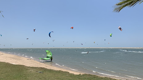
Jericoacoara Beach
Piranhas
Bonito
Buritizeiro
Chopinzinho
Gravataí
São Francisco de Paula
Espinosa
Belterra
Cachoeira do Arari
Aporé
Crateús
Sales Oliveira
Pontal do Paraná
Tracuateua
Ibotirama
Campo Alegre
Turmalina
Rodeiro
Jericoacoara Beach
Piranhas
Bonito
Buritizeiro
Chopinzinho
Gravataí
São Francisco de Paula
Espinosa
Belterra
Cachoeira do Arari
Aporé
Crateús
Sales Oliveira
Pontal do Paraná
Tracuateua
Ibotirama
Campo Alegre
Turmalina
Itarema on the map, Brazil
Where is located Itarema
Exact location — Itarema, Itarema, Ceará, Brazil, marked on the map with a red marker.
Coordinates
Itarema, Brazil coordinates in decimal format: latitude — -2.9209864, longitude — -39.9167627. When converted to degrees, minutes, seconds Itarema has the following coordinates: -2°55′15.55 north latitude and -39°55′0.35 east longitude.
Population
Itarema, Itarema, Ceará, Brazil, according to our data the population is — 10,330 residents, which is about 0% of the total population of the country (Brazil).
Comparison of the population on the graph:
Exact time
Time zone for this location Itarema — UTC -3 America/Fortaleza. Exact time — sunday, 4 april 2024 year, 02 h. 25 minutes.
Sunrise and sunset
Itarema, sunrise and sunset data for a date — sunday 28.04.2024.
| Sunrise | Sunset | Day (duration) |
|---|---|---|
| 05:38 -1 minute | 17:35 -0 minutes | 12 h. 0 minutes. +1 minute |
You can control the scale of the map using the auxiliary tools to find out exactly where it is located Itarema. When you change the scale of the map, the width of the ruler also changes (in kilometers and miles).
Nearby cities
The largest cities that are located nearby:
- Caucaia — 165 km
- Maracanaú — 177 km
- Fortaleza — 178 km
- Parnaíba — 205 km
- Mossoro — 378 km
- Teresina — 398 km
- Timon — 401 km
- Caxias — 436 km
- Juazeiro do Norte — 481 km
- São Luís — 484 km
- Natal — 607 km
- Parnamirim — 609 km
- Campina Grande — 650 km
- Santa Rita — 716 km
- Petrolina — 718 km
- João Pessoa — 725 km
- Caruaru — 734 km
- Camaragibe — 781 km
- Recife — 791 km
Distance to neighboring capitals:
- Paramaribo
 (Suriname) — 1958 km
 - Georgetown
 (Guyana) — 2297 km
 - Asuncion
 (Paraguay) — 3122 km
 - Asuncion (Paraguay) — 3128 km
- Caracas
 (Venezuela) — 3344 km
 - Nuestra Señora de La Paz
 (Bolivia) — 3436 km
 - Bogota
 (Colombia) — 3887 km
 - Montevideo
 (Uruguay) — 3933 km
 - Buenos Aires
 (Argentina) — 4008 km
 - Quito
 (Ecuador) — 4297 km
 - Santiago
 (Chile) — 4659 km