
 Bokamoso
Buysdorp
Xihosana
Ga-Sekororo
Ga-Rankuwa
Three Sisters
George
Haenertsburg
Polokwane
Bokamoso
Buysdorp
Xihosana
Ga-Sekororo
Ga-Rankuwa
Three Sisters
George
Haenertsburg
Polokwane
Oudtshoorn Golf Club on the map, Oudtshoorn, South Africa
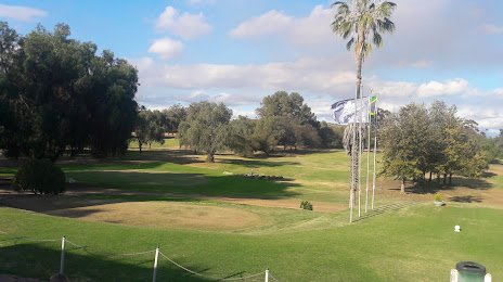
Photo
Where is located Oudtshoorn Golf Club
Oudtshoorn Golf Club — local attraction, which is located at 75 St Saviour St, Oudtshoorn, 6620, South Africa and belongs to the category — golf. Average visitor rating for this place — 3.8 (according to 103 ratings, information from open sources and relevant for 2022).
Exact location — Oudtshoorn Golf Club, marked on the map with a red marker.
You can get directions to Oudtshoorn Golf Club on the map from your location.
What else is interesting in Oudtshoorn? You can see all the sights if you go to the city page.
Coordinates
Oudtshoorn Golf Club, South Africa coordinates in decimal format: latitude — -33.62546231453872, longitude — 22.150459440165584. When converted to degrees, minutes, seconds Oudtshoorn Golf Club has the following coordinates: -33°37′31.66 north latitude and 22°9′1.65 east longitude.
Nearby cities
The largest cities that are located nearby:
- George — 46 km
- Mossel Bay — 65 km
- Worcester — 254 km
- Uitenhage — 296 km
- Paarl — 299 km
- Port Elizabeth — 314 km
- Cape Town — 348 km
- Queenstown — 482 km
- Bisho — 493 km
- East London — 530 km
- Kimberley — 592 km
- Bloemfontein — 629 km
- Botshabelo — 648 km
- Maseru
 (Lesotho) — 696 km
 - Virginia — 758 km
- Welkom — 762 km
- Kroonstad — 822 km
- Orkney — 854 km
- Klerksdorp — 864 km
Distance to the capital
Distance to the capital (Pretoria) is about — 1052 km.