
 Sassnitz
Auerbach
Bad Tölz
Kitzingen
Nordhorn
Stadtbergen
Horn
Königswinter
Engelbrechtsche Wildnis
Holsten
Alfdorf
Kirchlengern
Niedernhausen
Schmalkalden
Jarplund-Weding
Cologne
Pronsfeld
Heide
Werdohl
Sassnitz
Auerbach
Bad Tölz
Kitzingen
Nordhorn
Stadtbergen
Horn
Königswinter
Engelbrechtsche Wildnis
Holsten
Alfdorf
Kirchlengern
Niedernhausen
Schmalkalden
Jarplund-Weding
Cologne
Pronsfeld
Heide
Werdohl
Teningen on the map, Germany
Where is located Teningen
Exact location — Teningen, Freiburg, Baden-Württemberg, Germany, marked on the map with a red marker.
Coordinates
Teningen, Germany coordinates in decimal format: latitude — 48.1255252, longitude — 7.8138237. When converted to degrees, minutes, seconds Teningen has the following coordinates: 48°7′31.89 north latitude and 7°48′49.77 east longitude.
Population
Teningen, Freiburg, Baden-Württemberg, Germany, according to our data the population is — 11,939 residents, which is about 0% of the total population of the country (Germany).
Comparison of the population on the graph:
Exact time
Time zone for this location Teningen — UTC +2 Europe/Berlin. Exact time — wednesday, 5 may 2024 year, 07 h. 10 minutes.
Sunrise and sunset
Teningen, sunrise and sunset data for a date — wednesday 15.05.2024.
| Sunrise | Sunset | Day (duration) |
|---|---|---|
| 05:52 -1 minute | 20:57 +1 minute | 15 h. 6 minutes. +2 minutes |
You can control the scale of the map using the auxiliary tools to find out exactly where it is located Teningen. When you change the scale of the map, the width of the ruler also changes (in kilometers and miles).
Nearby cities
The largest cities that are located nearby:
- Freiburg — 14 km
- Strasbourg
 (France) — 50 km
 - Mulhouse (France) — 55 km
- Basel
 (Switzerland) — 64 km
 - Zurich (Switzerland) — 100 km
- Pforzheim — 106 km
- Karlsruhe — 106 km
- Reutlingen — 110 km
- Stuttgart — 123 km
- Bern (Switzerland) — 133 km
- Nancy (France) — 134 km
- Saarbrücken — 137 km
- Heilbronn — 151 km
- Heidelberg — 154 km
- Ludwigshafen — 156 km
- Mannheim — 158 km
- Metz (France) — 162 km
- Ulm — 162 km
- Besançon (France) — 166 km
Distance to neighboring capitals:
- Bern (Switzerland) — 134 km
- Vaduz
 (Liechtenstein) — 168 km
 - Brussels
 (Belgium) — 393 km
 - Paris (France) — 411 km
- Paris (France) — 411 km
- Amsterdam
 (Netherlands) — 516 km
 - Prague
 (Czech Republic) — 529 km
 - Ljubljana
 (Slovenia) — 556 km
 - Vienna
 (Austria) — 635 km
 - Rome
 (Italy) — 784 km
 - Copenhagen
 (Denmark) — 900 km
 - Warsaw
 (Poland) — 1043 km
 - Oslo
 (Norway) — 1325 km
 - Stockholm
 (Sweden) — 1408 km
 - Minsk
 (Belarus) — 1517 km
 - Kyiv
 (Ukraine) — 1661 km
 - Helsinki
 (Finland) — 1733 km
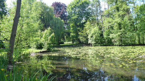
Attractions


Distance to the capital
Distance to the capital (Berlin) is about — 629 km.