
 Maureville
Samoëns
Gréning
Toulouse
Volx
Goudet
Méhoncourt
Saint-Hymer
Pontcarré
Maureville
Samoëns
Gréning
Toulouse
Volx
Goudet
Méhoncourt
Saint-Hymer
Pontcarré
Fosse-Maussoin State Park on the map, Montfermeil, France
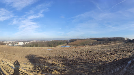
Photo
Where is located Fosse-Maussoin State Park
Fosse-Maussoin State Park — local attraction, which is located at 83 All. de la Chapelle, 93390 Clichy-sous-Bois, France and belongs to the category — park. Average visitor rating for this place — 4.1 (according to 141 rating, information from open sources and relevant for 2022).
Exact location — Fosse-Maussoin State Park, marked on the map with a red marker.
You can get directions to Fosse-Maussoin State Park on the map from your location.
What else is interesting in Montfermeil? You can see all the sights if you go to the city page.
Coordinates
Fosse-Maussoin State Park, France coordinates in decimal format: latitude — 48.90251964298187, longitude — 2.5352801752253606. When converted to degrees, minutes, seconds Fosse-Maussoin State Park has the following coordinates: 48°54′9.07 north latitude and 2°32′7.01 east longitude.
Nearby cities
The largest cities that are located nearby:
- Boulogne-Billancourt — 25 km
- Amiens — 111 km
- Reims — 113 km
- Orléans — 121 km
- Rouen — 121 km
- Le Havre — 189 km
- Lille — 194 km
- Le Mans — 201 km
- Charleroi
 (Belgium) — 213 km
 - Caen — 215 km
- Tours — 218 km
- Namur (Belgium) — 237 km
- Brussels (Belgium) — 249 km
- Dijon — 255 km
- Eastbourne
 (United Kingdom) — 261 km
 - Metz — 262 km
- Nancy — 265 km
- Angers — 282 km
- Liège (Belgium) — 285 km
Distance to the capital
Distance to the capital (Paris) is about — 14 km.