
 Belém
Maranguape
Paranaguá
Paranaguá
Monte Alegre
Alvorada de Minas
Bragança
Laguna
Ibiporã
Belém
Maranguape
Paranaguá
Paranaguá
Monte Alegre
Alvorada de Minas
Bragança
Laguna
Ibiporã
Parque do Jacarandá on the map, Uberaba, Brazil
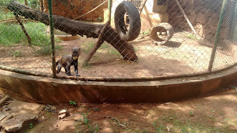
Photo
Where is located Parque do Jacarandá
Parque do Jacarandá — local attraction, which is located at R. João Luís Alvarenga, 546 - Jardim Sao Bento, Uberaba - MG, 38066-200, Brazil and belongs to the category — city park. Average visitor rating for this place — 3.6 (according to 353 ratings, information from open sources and relevant for 2022).
Exact location — Parque do Jacarandá, marked on the map with a red marker.
You can get directions to Parque do Jacarandá on the map from your location.
What else is interesting in Uberaba? You can see all the sights if you go to the city page.
Coordinates
Parque do Jacarandá, Brazil coordinates in decimal format: latitude — -19.735158930697406, longitude — -47.94364837553908. When converted to degrees, minutes, seconds Parque do Jacarandá has the following coordinates: -19°44′6.57 north latitude and -47°56′37.13 east longitude.
Nearby cities
The largest cities that are located nearby:
- Uberlândia — 99 km
- Franca — 104 km
- Barretos — 111 km
- Ribeirão Preto — 158 km
- Catanduva — 187 km
- Patos de Minas — 197 km
- Araraquara — 227 km
- São Carlos — 250 km
- Poços de Caldas — 266 km
- Araras — 295 km
- Rio Claro — 297 km
- Birigui — 301 km
- Bauru — 306 km
- Divinópolis — 319 km
- Piracicaba — 332 km
- Americana — 336 km
- Santa Bárbara D'Oeste — 337 km
- Marília — 342 km
- Sumaré — 347 km