 Pointe-à-la-Croix
Sainte-Irène, Quebec
Marsoui
Hecla
Muskrat Dam
Wunnummin Lake
Sainte-Brigitte-de-Laval
Drayton
Mauricie
Pointe-à-la-Croix
Sainte-Irène, Quebec
Marsoui
Hecla
Muskrat Dam
Wunnummin Lake
Sainte-Brigitte-de-Laval
Drayton
Mauricie
Trepanier Creek Greenway Regional Park on the map, West Kelowna, Canada
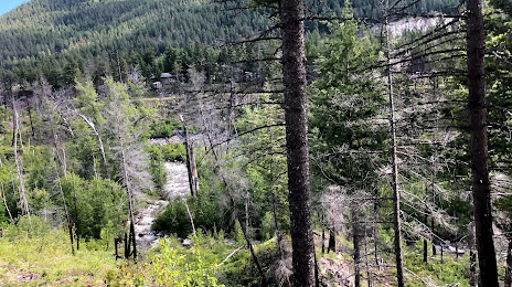
Photo
Where is located Trepanier Creek Greenway Regional Park
Trepanier Creek Greenway Regional Park — local attraction, which is located at Trepanier Rd, Peachland, BC V0H 1X2, Canada and belongs to the category — park. Average visitor rating for this place — 4.6 (according to 32 ratings, information from open sources and relevant for 2022).
Exact location — Trepanier Creek Greenway Regional Park, marked on the map with a red marker.
You can get directions to Trepanier Creek Greenway Regional Park on the map from your location.
What else is interesting in West Kelowna? You can see all the sights if you go to the city page.
Coordinates
Trepanier Creek Greenway Regional Park, Canada coordinates in decimal format: latitude — 49.8076502217827, longitude — -119.74375242474233. When converted to degrees, minutes, seconds Trepanier Creek Greenway Regional Park has the following coordinates: 49°48′27.54 north latitude and -119°44′37.51 east longitude.
Nearby cities
The largest cities that are located nearby:
- Kelowna — 6 km
- Abbotsford — 219 km
- Coquitlam — 242 km
- Anmore — 245 km
- Surrey — 249 km
- Burnaby — 254 km
- Vancouver — 264 km
- Delta — 265 km
- Richmond — 269 km
- Spokane
 (United States) — 291 km
 - Bellevue (United States) — 317 km
- Victoria — 321 km
- Seattle (United States) — 324 km
- Tacoma (United States) — 361 km
- Calgary — 404 km
- Portland (United States) — 537 km
- Edmonton — 570 km
- Salem (United States) — 608 km
- Eugene (United States) — 701 km
Distance to the capital
Distance to the capital (Ottawa) is about — 3290 km.