
 Bokamoso
Buysdorp
Xihosana
Ga-Sekororo
Ga-Rankuwa
Three Sisters
George
Haenertsburg
Polokwane
Bokamoso
Buysdorp
Xihosana
Ga-Sekororo
Ga-Rankuwa
Three Sisters
George
Haenertsburg
Polokwane
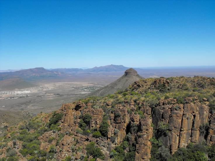
Camdeboo National Park on the map, Graaff-Reinet, South Africa
Photo
Where is located Camdeboo National Park
Camdeboo National Park — local attraction, which is located at 20 N9, Graaff-Reinet, 6280, South Africa and belongs to the category — national park. Average visitor rating for this place — 4.4 (according to 1077 ratings, information from open sources and relevant for 2022).
Exact location — Camdeboo National Park, marked on the map with a red marker.
You can get directions to Camdeboo National Park on the map from your location.
What else is interesting in Graaff-Reinet? You can see all the sights if you go to the city page.
Coordinates
Camdeboo National Park, South Africa coordinates in decimal format: latitude — -32.22043542597835, longitude — 24.541217424717424. When converted to degrees, minutes, seconds Camdeboo National Park has the following coordinates: -32°13′13.57 north latitude and 24°32′28.38 east longitude.
Nearby cities
The largest cities that are located nearby:
- Uitenhage — 185 km
- Port Elizabeth — 212 km
- Queenstown — 227 km
- George — 270 km
- Bisho — 276 km
- Mossel Bay — 307 km
- East London — 318 km
- Bloemfontein — 383 km
- Kimberley — 389 km
- Botshabelo — 391 km
- Maseru
 (Lesotho) — 431 km
 - Worcester — 494 km
- Virginia — 511 km
- Welkom — 518 km
- Paarl — 539 km
- Kroonstad — 573 km
- Cape Town — 591 km
- Orkney — 620 km
- Klerksdorp — 631 km
Distance to the capital
Distance to the capital (Pretoria) is about — 803 km.