
 Itoshima
Saikai
Izumi
Ichikikushikino
Uruma
Kirishima
Kunisaki
Bungotakada
Gotsu
Itoshima
Saikai
Izumi
Ichikikushikino
Uruma
Kirishima
Kunisaki
Bungotakada
Gotsu
Aki Region Park Community Zone on the map, Aki, Japan
Photo
Where is located Aki Region Park Community Zone
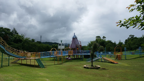
Aki Region Park Community Zone — local attraction, which is located at Kawakitaotsu, Aki, Kochi 784-0044, Japan and belongs to the category — park. Average visitor rating for this place — 4.1 (according to 95 ratings, information from open sources and relevant for 2022).
Exact location — Aki Region Park Community Zone, marked on the map with a red marker.
You can get directions to Aki Region Park Community Zone on the map from your location.
What else is interesting in Aki? You can see all the sights if you go to the city page.
Coordinates
Aki Region Park Community Zone, Japan coordinates in decimal format: latitude — 33.52837683415527, longitude — 133.91125202475087. When converted to degrees, minutes, seconds Aki Region Park Community Zone has the following coordinates: 33°31′42.16 north latitude and 133°54′40.51 east longitude.
Nearby cities
The largest cities that are located nearby:
- Kochi — 35 km
- Niihama — 76 km
- Tokushima — 86 km
- Imabari — 104 km
- Matsuyama — 111 km
- Fukuyama — 120 km
- Kurashiki — 120 km
- Okayama — 127 km
- Wakayama — 141 km
- Kure — 148 km
- Akashi — 160 km
- Himeji — 161 km
- Hiroshima — 165 km
- Kishiwada — 170 km
- Iwakuni — 171 km
- Kobe — 176 km
- Nishinomiya — 189 km
- Tondabayashi — 189 km
- Matsubara — 191 km