
 Gilserberg
Berlin
Bordesholm
Bechtolsheim
Aub
Triptis
Heppenheim
Biblis
Angermünde
Gilserberg
Berlin
Bordesholm
Bechtolsheim
Aub
Triptis
Heppenheim
Biblis
Angermünde
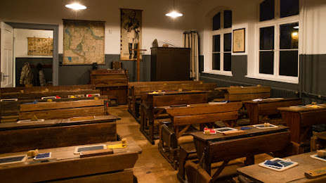
Heimat- und Schulmuseum Himmelpforten on the map, Stade, Germany
Photo
Where is located Heimat- und Schulmuseum Himmelpforten
Heimat- und Schulmuseum Himmelpforten — local attraction, which is located at 21709, Kamphof, Poststraße 6A, 21709 Himmelpforten, Germany and belongs to the category — museum. Average visitor rating for this place — 4.6 (according to 17 ratings, information from open sources and relevant for 2022).
Exact location — Heimat- und Schulmuseum Himmelpforten, marked on the map with a red marker.
You can get directions to Heimat- und Schulmuseum Himmelpforten on the map from your location.
What else is interesting in Stade? You can see all the sights if you go to the city page.
Coordinates
Heimat- und Schulmuseum Himmelpforten, Germany coordinates in decimal format: latitude — 53.61379873928307, longitude — 9.30784892539799. When converted to degrees, minutes, seconds Heimat- und Schulmuseum Himmelpforten has the following coordinates: 53°36′49.68 north latitude and 9°18′28.26 east longitude.
Nearby cities
The largest cities that are located nearby:
- Bremerhaven — 59 km
- Bremen — 72 km
- Kiel — 91 km
- Hanover — 136 km
- Wolfsburg — 157 km
- Hildesheim — 162 km
- Brunswick — 163 km
- Salzgitter — 170 km
- Osnabrück — 174 km
- Rostock — 179 km
- Bielefeld — 184 km
- Emmen
 (Netherlands) — 194 km
 - Groningen (Netherlands) — 197 km
- Odense
 (Denmark) — 209 km
 - Paderborn — 213 km
- Magdeburg — 219 km
- Münster — 220 km
- Göttingen — 229 km
- Enschede (Netherlands) — 231 km
Distance to the capital
Distance to the capital (Berlin) is about — 300 km.