
 Gilserberg
Berlin
Bordesholm
Bechtolsheim
Aub
Triptis
Heppenheim
Biblis
Angermünde
Gilserberg
Berlin
Bordesholm
Bechtolsheim
Aub
Triptis
Heppenheim
Biblis
Angermünde
Eckernförde Bay on the map, Eckernförde, Germany
Photo
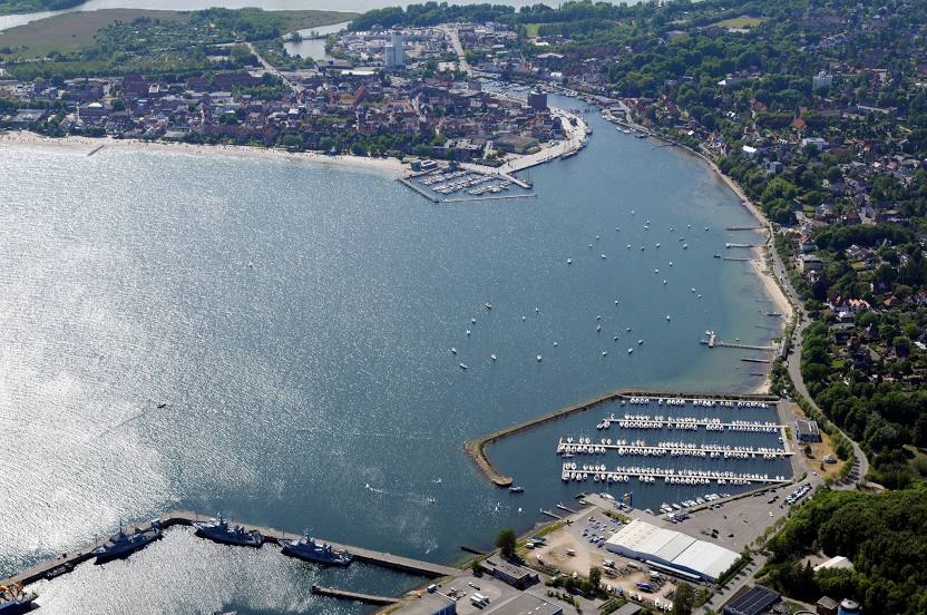
Where is located Eckernförde Bay
Eckernförde Bay — local attraction, which is located at 26 m and belongs to the category — -. Average visitor rating for this place — - (according to 0 ratings, information from open sources and relevant for 2022).
Exact location — Eckernförde Bay, marked on the map with a red marker.
You can get directions to Eckernförde Bay on the map from your location.
What else is interesting in Eckernförde? You can see all the sights if you go to the city page.
Coordinates
Eckernförde Bay, Germany coordinates in decimal format: latitude — 54.46394999782442, longitude — 9.946934416151128. When converted to degrees, minutes, seconds Eckernförde Bay has the following coordinates: 54°27′50.22 north latitude and 9°56′48.96 east longitude.
Nearby cities
The largest cities that are located nearby:
- Kiel — 24 km
- Odense
 (Denmark) — 109 km
 - Bremerhaven — 132 km
- Rostock — 152 km
- Bremen — 168 km
- Aarhus (Denmark) — 189 km
- Copenhagen (Denmark) — 216 km
- Hanover — 232 km
- Malmö
 (Sweden) — 234 km
 - Wolfsburg — 235 km
- Brunswick — 248 km
- Hildesheim — 256 km
- Groningen
 (Netherlands) — 257 km
 - Salzgitter — 259 km
- Osnabrück — 271 km
- Emmen (Netherlands) — 271 km
- Bielefeld — 284 km
- Aalborg (Denmark) — 285 km
- Magdeburg — 287 km
Distance to the capital
Distance to the capital (Berlin) is about — 315 km.