
 Olvera
Becerreá
Mazaricos
Murchante
Algar de Palancia
Cantoria
Els Guiamets
Nulles
Dicastillo
Casaseca de las Chanas
Jerte
San Cristobal de La Laguna
Polán
San Leonardo de Yagüe
Bolulla
La Cabrera
Foios
Castronuño
El Poal
Olvera
Becerreá
Mazaricos
Murchante
Algar de Palancia
Cantoria
Els Guiamets
Nulles
Dicastillo
Casaseca de las Chanas
Jerte
San Cristobal de La Laguna
Polán
San Leonardo de Yagüe
Bolulla
La Cabrera
Foios
Castronuño
El Poal
Sant Celoni on the map, Spain
Where is located Sant Celoni
Exact location — Sant Celoni, Barcelona, Catalunya, Spain, marked on the map with a red marker.
Coordinates
Sant Celoni, Spain coordinates in decimal format: latitude — 41.6897479, longitude — 2.4892465. When converted to degrees, minutes, seconds Sant Celoni has the following coordinates: 41°41′23.09 north latitude and 2°29′21.29 east longitude.
Population
Sant Celoni, Barcelona, Catalunya, Spain, according to our data the population is — 16,860 residents, which is about 0% of the total population of the country (Spain).
Comparison of the population on the graph:
Exact time
Time zone for this location Sant Celoni — UTC +2 Europe/Madrid. Exact time — sunday, 5 may 2024 year, 18 h. 22 minutes.
Sunrise and sunset
Sant Celoni, sunrise and sunset data for a date — sunday 5.05.2024.
| Sunrise | Sunset | Day (duration) |
|---|---|---|
| 06:44 -1 minute | 20:49 +1 minute | 14 h. 6 minutes. +2 minutes |
You can control the scale of the map using the auxiliary tools to find out exactly where it is located Sant Celoni. When you change the scale of the map, the width of the ruler also changes (in kilometers and miles).
Nearby cities
The largest cities that are located nearby:
- Mataró — 17 km
- Badalona — 34 km
- Sabadell — 35 km
- Santa Coloma de Gramenet — 36 km
- Terrassa — 42 km
- L'Hospitalet de Llobregat — 47 km
- Perpignan
 (France) — 115 km
 - Tarragona — 121 km
- Lleida — 155 km
- Toulouse (France) — 228 km
- Palma — 235 km
- Montpellier (France) — 240 km
- Zaragoza — 279 km
- Nimes (France) — 280 km
- Marseille (France) — 292 km
- Aix-en-Provence (France) — 312 km
- Toulon (France) — 320 km
- Valencia — 346 km
- Pamplona — 358 km
Distance to neighboring capitals:
- Andorra la Vella
 (Andorra) — 121 km
 - Paris (France) — 797 km
- Paris (France) — 797 km
- Lisbon
 (Portugal) — 1040 km
 - Rabat
 (Morocco) — 1186 km
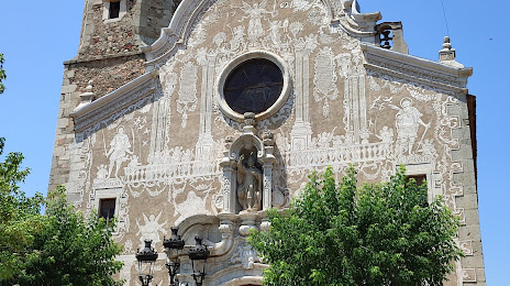
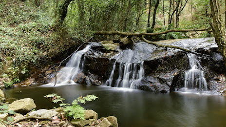
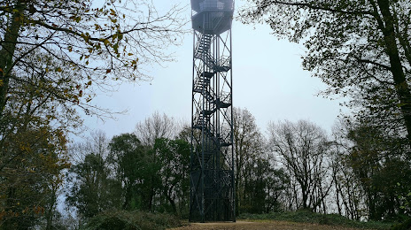
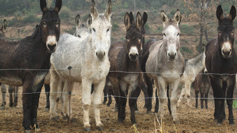
Attractions


Distance to the capital
Distance to the capital (Madrid) is about — 538 km.