
 Gilserberg
Berlin
Bordesholm
Bechtolsheim
Aub
Triptis
Heppenheim
Biblis
Angermünde
Gilserberg
Berlin
Bordesholm
Bechtolsheim
Aub
Triptis
Heppenheim
Biblis
Angermünde
Michaeliskirche / Michałska cyrkej on the map, Bautzen, Germany
Photo
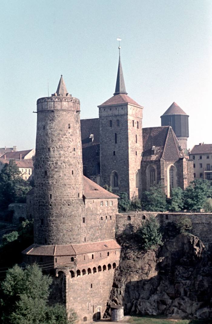
Where is located Michaeliskirche / Michałska cyrkej
Michaeliskirche / Michałska cyrkej — local attraction, which is located at Wendischer Kirchhof 1, 02625 Bautzen, Germany and belongs to the category — evangelical church. Average visitor rating for this place — 4.6 (according to 57 ratings, information from open sources and relevant for 2022).
Exact location — Michaeliskirche / Michałska cyrkej, marked on the map with a red marker.
You can get directions to Michaeliskirche / Michałska cyrkej on the map from your location.
What else is interesting in Bautzen? You can see all the sights if you go to the city page.
Coordinates
Michaeliskirche / Michałska cyrkej, Germany coordinates in decimal format: latitude — 51.181004014837235, longitude — 14.4208707253074. When converted to degrees, minutes, seconds Michaeliskirche / Michałska cyrkej has the following coordinates: 51°10′51.61 north latitude and 14°25′15.13 east longitude.
Nearby cities
The largest cities that are located nearby:
- Dresden — 50 km
- Cottbus — 64 km
- Zielona Gora
 (Poland) — 111 km
 - Chemnitz — 112 km
- Legnica (Poland) — 120 km
- Prague
 (Czech Republic) — 122 km
 - Walbrzych (Poland) — 137 km
- Leipzig — 143 km
- Berlin — 161 km
- Potsdam — 162 km
- Gera — 167 km
- Pilsen (Czech Republic) — 176 km
- Gorzów Wielkopolski (Poland) — 180 km
- Wrocław (Poland) — 182 km
- Poznań (Poland) — 216 km
- Magdeburg — 216 km
- Erfurt — 237 km
- Szczecin (Poland) — 248 km
- Opole (Poland) — 251 km
Distance to the capital
Distance to the capital (Berlin) is about — 164 km.