
 Gilserberg
Berlin
Bordesholm
Bechtolsheim
Aub
Triptis
Heppenheim
Biblis
Angermünde
Gilserberg
Berlin
Bordesholm
Bechtolsheim
Aub
Triptis
Heppenheim
Biblis
Angermünde
Unstrut-Lamas on the map, Bad Langensalza, Germany
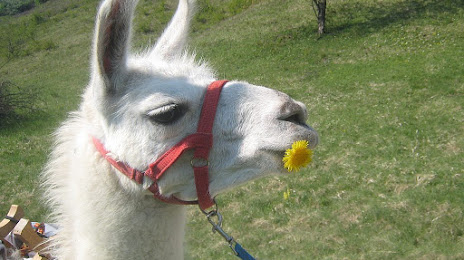
Photo
Where is located Unstrut-Lamas
Unstrut-Lamas — local attraction, which is located at Valentin-Thau-Straße 13, 99955 Herbsleben, Germany and belongs to the category — hiking area. Average visitor rating for this place — 4.6 (according to 46 ratings, information from open sources and relevant for 2022).
Exact location — Unstrut-Lamas, marked on the map with a red marker.
You can get directions to Unstrut-Lamas on the map from your location.
What else is interesting in Bad Langensalza? You can see all the sights if you go to the city page.
Coordinates
Unstrut-Lamas, Germany coordinates in decimal format: latitude — 51.11265276997379, longitude — 10.649807525304933. When converted to degrees, minutes, seconds Unstrut-Lamas has the following coordinates: 51°6′45.55 north latitude and 10°38′59.31 east longitude.
Nearby cities
The largest cities that are located nearby:
- Erfurt — 30 km
- Göttingen — 69 km
- Kassel — 84 km
- Gera — 103 km
- Salzgitter — 117 km
- Leipzig — 122 km
- Hildesheim — 125 km
- Brunswick — 128 km
- Magdeburg — 130 km
- Wolfsburg — 146 km
- Paderborn — 146 km
- Hanover — 153 km
- Würzburg — 154 km
- Chemnitz — 162 km
- Erlangen — 170 km
- Offenbach — 174 km
- Bielefeld — 176 km
- Frankfurt — 178 km
- Fürth — 182 km
Distance to the capital
Distance to the capital (Berlin) is about — 246 km.