
 Gilserberg
Berlin
Bordesholm
Bechtolsheim
Aub
Triptis
Heppenheim
Biblis
Angermünde
Gilserberg
Berlin
Bordesholm
Bechtolsheim
Aub
Triptis
Heppenheim
Biblis
Angermünde
Rundfunk-Museum Cham on the map, Cham, Germany
Photo
Where is located Rundfunk-Museum Cham
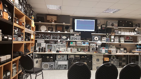
Rundfunk-Museum Cham — local attraction, which is located at Sudetenstraße 2, 93413 Cham, Germany and belongs to the category — museum. Average visitor rating for this place — 4.8 (according to 34 ratings, information from open sources and relevant for 2022).
Exact location — Rundfunk-Museum Cham, marked on the map with a red marker.
You can get directions to Rundfunk-Museum Cham on the map from your location.
What else is interesting in Cham? You can see all the sights if you go to the city page.
Coordinates
Rundfunk-Museum Cham, Germany coordinates in decimal format: latitude — 49.2037862347573, longitude — 12.668094125236044. When converted to degrees, minutes, seconds Rundfunk-Museum Cham has the following coordinates: 49°12′13.63 north latitude and 12°40′5.14 east longitude.
Nearby cities
The largest cities that are located nearby:
- Regensburg — 47 km
- Pilsen
 (Czech Republic) — 76 km
 - Ingolstadt — 103 km
- Nuremberg — 117 km
- Fürth — 123 km
- Erlangen — 125 km
- Munich — 144 km
- Linz
 (Austria) — 157 km
 - Prague (Czech Republic) — 157 km
- Salzburg (Austria) — 159 km
- Augsburg — 160 km
- Chemnitz — 178 km
- Gera — 188 km
- Würzburg — 203 km
- Dresden — 215 km
- Ulm — 216 km
- Erfurt — 225 km
- Leipzig — 235 km
- Innsbruck (Austria) — 236 km
Distance to the capital
Distance to the capital (Berlin) is about — 372 km.