
 Gilserberg
Berlin
Bordesholm
Bechtolsheim
Aub
Triptis
Heppenheim
Biblis
Angermünde
Gilserberg
Berlin
Bordesholm
Bechtolsheim
Aub
Triptis
Heppenheim
Biblis
Angermünde
Mineralien- und Bergbaumuseum on the map, Hückelhoven, Germany
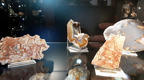
Photo
Where is located Mineralien- und Bergbaumuseum
Mineralien- und Bergbaumuseum — local attraction, which is located at Ludovicistraße 1, 41836 Hückelhoven, Germany and belongs to the category — museum. Average visitor rating for this place — 4.5 (according to 48 ratings, information from open sources and relevant for 2022).
Exact location — Mineralien- und Bergbaumuseum, marked on the map with a red marker.
You can get directions to Mineralien- und Bergbaumuseum on the map from your location.
What else is interesting in Hückelhoven? You can see all the sights if you go to the city page.
Coordinates
Mineralien- und Bergbaumuseum, Germany coordinates in decimal format: latitude — 51.06034963567292, longitude — 6.222435625303026. When converted to degrees, minutes, seconds Mineralien- und Bergbaumuseum has the following coordinates: 51°3′37.26 north latitude and 6°13′20.77 east longitude.
Nearby cities
The largest cities that are located nearby:
- Mönchengladbach — 21 km
- Aachen — 32 km
- Neuss — 36 km
- Krefeld — 40 km
- Düsseldorf — 43 km
- Maastricht
 (Netherlands) — 43 km
 - Moers — 53 km
- Cologne — 53 km
- Duisburg — 56 km
- Mülheim — 61 km
- Solingen — 61 km
- Bergisch Gladbach — 63 km
- Liège
 (Belgium) — 65 km
 - Oberhausen — 66 km
- Eindhoven (Netherlands) — 67 km
- Wuppertal — 68 km
- Remscheid — 68 km
- Essen — 70 km
- Bonn — 71 km
Distance to the capital
Distance to the capital (Berlin) is about — 520 km.