
 Józefów nad Wisłą
Gorzyce Wielkie
Rogówek
Sromowce Niżne
Wyszków County
Kruszewo
Jantar
Sady Górne
Nagoszewo
Józefów nad Wisłą
Gorzyce Wielkie
Rogówek
Sromowce Niżne
Wyszków County
Kruszewo
Jantar
Sady Górne
Nagoszewo
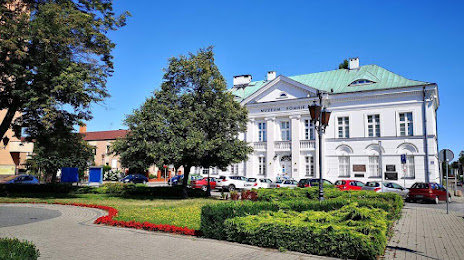
Museum of Sochaczew's area and Battle on Bzura on the map, Sochaczew, Poland
Photo
Where is located Museum of Sochaczew's area and Battle on Bzura
Museum of Sochaczew's area and Battle on Bzura — local attraction, which is located at Plac Tadeusza Kościuszki 12, 96-500 Sochaczew, Poland and belongs to the category — museum. Average visitor rating for this place — 4.5 (according to 210 ratings, information from open sources and relevant for 2022).
Exact location — Museum of Sochaczew's area and Battle on Bzura, marked on the map with a red marker.
You can get directions to Museum of Sochaczew's area and Battle on Bzura on the map from your location.
What else is interesting in Sochaczew? You can see all the sights if you go to the city page.
Coordinates
Museum of Sochaczew's area and Battle on Bzura, Poland coordinates in decimal format: latitude — 52.22997040872275, longitude — 20.23715782534614. When converted to degrees, minutes, seconds Museum of Sochaczew's area and Battle on Bzura has the following coordinates: 52°13′47.89 north latitude and 20°14′13.77 east longitude.
Nearby cities
The largest cities that are located nearby:
- Plock — 50 km
- Łódź — 75 km
- Wloclawek — 91 km
- Radom — 111 km
- Torun — 139 km
- Kielce — 153 km
- Kalisz — 156 km
- Olsztyn — 172 km
- Częstochowa — 175 km
- Bydgoszcz — 178 km
- Lublin — 194 km
- Bialystok — 219 km
- Elblag — 220 km
- Dabrowa Gornicza — 223 km
- Poznań — 224 km
- Bytom — 228 km
- Sosnowiec — 229 km
- Chorzow — 232 km
- Katowice — 234 km
Distance to the capital
Distance to the capital (Warsaw) is about — 53 km.