
 Puerto de la Duquesa
La Serna de Iguña
Pumalverde
Puentenansa
La Iglesia
Casar de Periedo
Fuengirola
Renedo de Piélagos
Villabanez
Puerto de la Duquesa
La Serna de Iguña
Pumalverde
Puentenansa
La Iglesia
Casar de Periedo
Fuengirola
Renedo de Piélagos
Villabanez
Vía verde del Aceite on the map, Torre del Campo, Spain
Photo
Where is located Vía verde del Aceite
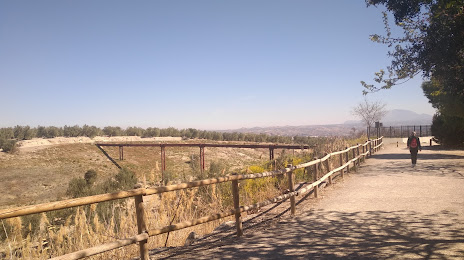
Vía verde del Aceite — local attraction, which is located at P.º de la Estación, 69, 23640 Torre del Campo, Jaén, Spain and belongs to the category — hiking area. Average visitor rating for this place — 4.5 (according to 416 ratings, information from open sources and relevant for 2022).
Exact location — Vía verde del Aceite, marked on the map with a red marker.
You can get directions to Vía verde del Aceite on the map from your location.
What else is interesting in Torre del Campo? You can see all the sights if you go to the city page.
Coordinates
Vía verde del Aceite, Spain coordinates in decimal format: latitude — 37.774464018089404, longitude — -3.9031859751329407. When converted to degrees, minutes, seconds Vía verde del Aceite has the following coordinates: 37°46′28.07 north latitude and -3°54′11.47 east longitude.
Nearby cities
The largest cities that are located nearby:
- Jaén — 10 km
- Granada — 71 km
- Córdoba — 78 km
- Málaga — 125 km
- Almería — 164 km
- Marbella — 164 km
- Dos Hermanas — 186 km
- Albacete — 222 km
- Algeciras — 227 km
- Jerez — 231 km
- Murcia — 243 km
- Cádiz — 253 km
- Cartagena — 255 km
- Huelva — 274 km
- Tetouan
 (Morocco) — 277 km
 - Fuenlabrada — 279 km
- Getafe — 281 km
- Tangier (Morocco) — 282 km
- Móstoles — 282 km
Distance to the capital
Distance to the capital (Madrid) is about — 294 km.