
 Gilserberg
Berlin
Bordesholm
Bechtolsheim
Aub
Triptis
Heppenheim
Biblis
Angermünde
Gilserberg
Berlin
Bordesholm
Bechtolsheim
Aub
Triptis
Heppenheim
Biblis
Angermünde
Klosterruine Heilig Kreuz on the map, Meissen, Germany
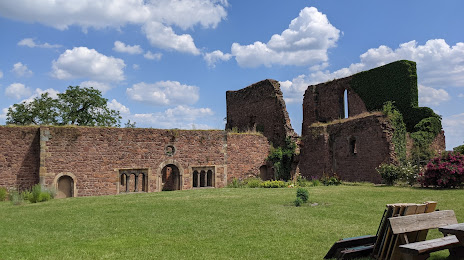
Photo
Where is located Klosterruine Heilig Kreuz
Klosterruine Heilig Kreuz — local attraction, which is located at Leipziger Str. 94, 01662 Meißen, Germany and belongs to the category — historical landmark. Average visitor rating for this place — 4.6 (according to 279 ratings, information from open sources and relevant for 2022).
Exact location — Klosterruine Heilig Kreuz, marked on the map with a red marker.
You can get directions to Klosterruine Heilig Kreuz on the map from your location.
What else is interesting in Meissen? You can see all the sights if you go to the city page.
Coordinates
Klosterruine Heilig Kreuz, Germany coordinates in decimal format: latitude — 51.174888310821295, longitude — 13.458836925307168. When converted to degrees, minutes, seconds Klosterruine Heilig Kreuz has the following coordinates: 51°10′29.6 north latitude and 13°27′31.81 east longitude.
Nearby cities
The largest cities that are located nearby:
- Dresden — 21 km
- Chemnitz — 55 km
- Leipzig — 80 km
- Cottbus — 87 km
- Gera — 103 km
- Prague
 (Czech Republic) — 137 km
 - Potsdam — 139 km
- Berlin — 148 km
- Pilsen (Czech Republic) — 158 km
- Zielona Gora
 (Poland) — 161 km
 - Magdeburg — 165 km
- Erfurt — 173 km
- Legnica (Poland) — 184 km
- Walbrzych (Poland) — 199 km
- Gorzów Wielkopolski (Poland) — 209 km
- Wolfsburg — 230 km
- Brunswick — 235 km
- Salzgitter — 241 km
- Wrocław (Poland) — 246 km
Distance to the capital
Distance to the capital (Berlin) is about — 150 km.