
 Puerto de la Duquesa
La Serna de Iguña
Pumalverde
Puentenansa
La Iglesia
Casar de Periedo
Fuengirola
Renedo de Piélagos
Villabanez
Puerto de la Duquesa
La Serna de Iguña
Pumalverde
Puentenansa
La Iglesia
Casar de Periedo
Fuengirola
Renedo de Piélagos
Villabanez
Jungle Park on the map, Adeje, Spain
Photo
Where is located Jungle Park
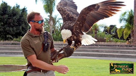
Jungle Park — local attraction, which is located at Urb. Águilas del Teide, s/n, Km. 3, 38640 Arona, Santa Cruz de Tenerife, Spain and belongs to the category — zoological park. Average visitor rating for this place — 4.3 (according to 5519 ratings, information from open sources and relevant for 2022).
Exact location — Jungle Park, marked on the map with a red marker.
You can get directions to Jungle Park on the map from your location.
What else is interesting in Adeje? You can see all the sights if you go to the city page.
Coordinates
Jungle Park, Spain coordinates in decimal format: latitude — 28.079623785688526, longitude — -16.69539417538025. When converted to degrees, minutes, seconds Jungle Park has the following coordinates: 28°4′46.65 north latitude and -16°41′43.42 east longitude.
Nearby cities
The largest cities that are located nearby:
- Santa Cruz de Tenerife — 60 km
- Las Palmas de Gran Canaria — 127 km
- Telde — 129 km
- Agadir
 (Morocco) — 726 km
 - Essaouira (Morocco) — 757 km
- Safi (Morocco) — 840 km
- Marrakesh (Morocco) — 908 km
- El Jadida (Morocco) — 948 km
- Ouarzazate (Morocco) — 980 km
- Casablanca (Morocco) — 1036 km
- Azilal (Morocco) — 1044 km
- Khouribga (Morocco) — 1052 km
- Mohammedia (Morocco) — 1057 km
- Temara (Morocco) — 1107 km
- Nouakchott
 (Mauritania) — 1111 km
 - Sale (Morocco) — 1123 km
- Kenitra (Morocco) — 1149 km
- Khenifra (Morocco) — 1157 km
- Khemisset (Morocco) — 1165 km
Distance to the capital
Distance to the capital (Madrid) is about — 1815 km.