
 Gilserberg
Berlin
Bordesholm
Bechtolsheim
Aub
Triptis
Heppenheim
Biblis
Angermünde
Gilserberg
Berlin
Bordesholm
Bechtolsheim
Aub
Triptis
Heppenheim
Biblis
Angermünde
Löbauer Berg on the map, Löbau, Germany
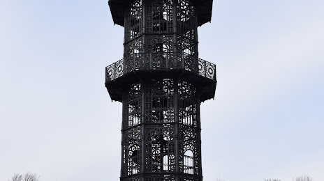
Photo
Where is located Löbauer Berg
Löbauer Berg — local attraction, which is located at 448 m and belongs to the category — -. Average visitor rating for this place — 4.8 (according to 37 ratings, information from open sources and relevant for 2022).
Exact location — Löbauer Berg, marked on the map with a red marker.
You can get directions to Löbauer Berg on the map from your location.
What else is interesting in Löbau? You can see all the sights if you go to the city page.
Coordinates
Löbauer Berg, Germany coordinates in decimal format: latitude — 51.09040005537721, longitude — 14.690226125304175. When converted to degrees, minutes, seconds Löbauer Berg has the following coordinates: 51°5′25.44 north latitude and 14°41′24.81 east longitude.
Nearby cities
The largest cities that are located nearby:
- Dresden — 65 km
- Cottbus — 77 km
- Legnica
 (Poland) — 104 km
 - Zielona Gora (Poland) — 109 km
- Prague
 (Czech Republic) — 114 km
 - Walbrzych (Poland) — 118 km
- Chemnitz — 126 km
- Leipzig — 161 km
- Wrocław (Poland) — 164 km
- Pilsen (Czech Republic) — 176 km
- Berlin — 177 km
- Potsdam — 179 km
- Gera — 182 km
- Gorzów Wielkopolski (Poland) — 185 km
- Poznań (Poland) — 210 km
- Opole (Poland) — 233 km
- Magdeburg — 236 km
- Kalisz (Poland) — 245 km
- Olomouc (Czech Republic) — 249 km
Distance to the capital
Distance to the capital (Berlin) is about — 182 km.