
 Józefów nad Wisłą
Gorzyce Wielkie
Rogówek
Sromowce Niżne
Wyszków County
Kruszewo
Jantar
Sady Górne
Nagoszewo
Józefów nad Wisłą
Gorzyce Wielkie
Rogówek
Sromowce Niżne
Wyszków County
Kruszewo
Jantar
Sady Górne
Nagoszewo
Regionalmuseum (Muzeum Regionalne) on the map, Swiebodzin, Poland
Photo
Where is located Regionalmuseum (Muzeum Regionalne)
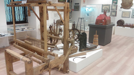
Regionalmuseum (Muzeum Regionalne) — local attraction, which is located at plac Jana Pawła II 1, 66-200 Świebodzin, Poland and belongs to the category — museum. Average visitor rating for this place — 4.6 (according to 49 ratings, information from open sources and relevant for 2022).
Exact location — Regionalmuseum (Muzeum Regionalne), marked on the map with a red marker.
You can get directions to Regionalmuseum (Muzeum Regionalne) on the map from your location.
What else is interesting in Swiebodzin? You can see all the sights if you go to the city page.
Coordinates
Regionalmuseum (Muzeum Regionalne), Poland coordinates in decimal format: latitude — 52.2498259219536, longitude — 15.532789725346827. When converted to degrees, minutes, seconds Regionalmuseum (Muzeum Regionalne) has the following coordinates: 52°14′59.37 north latitude and 15°31′58.04 east longitude.
Nearby cities
The largest cities that are located nearby:
- Zielona Gora — 35 km
- Gorzów Wielkopolski — 57 km
- Poznań — 96 km
- Cottbus
 (Germany) — 98 km
 - Legnica — 123 km
- Szczecin — 146 km
- Berlin (Germany) — 146 km
- Berlin (Germany) — 147 km
- Wrocław — 164 km
- Potsdam (Germany) — 167 km
- Walbrzych — 170 km
- Dresden (Germany) — 182 km
- Kalisz — 182 km
- Bydgoszcz — 191 km
- Koszalin — 219 km
- Torun — 221 km
- Leipzig (Germany) — 240 km
- Chemnitz (Germany) — 241 km
- Wloclawek — 241 km
Distance to the capital
Distance to the capital (Warsaw) is about — 373 km.