
 Gilserberg
Berlin
Bordesholm
Bechtolsheim
Aub
Triptis
Heppenheim
Biblis
Angermünde
Gilserberg
Berlin
Bordesholm
Bechtolsheim
Aub
Triptis
Heppenheim
Biblis
Angermünde
Iburg-Ruine on the map, Bad Driburg, Germany
Photo
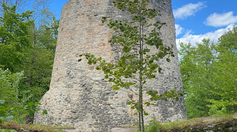
Where is located Iburg-Ruine
Iburg-Ruine — local attraction, which is located at 33014 Bad Driburg, Germany and belongs to the category — historical landmark. Average visitor rating for this place — 4.4 (according to 384 ratings, information from open sources and relevant for 2022).
Exact location — Iburg-Ruine, marked on the map with a red marker.
You can get directions to Iburg-Ruine on the map from your location.
What else is interesting in Bad Driburg? You can see all the sights if you go to the city page.
Coordinates
Iburg-Ruine, Germany coordinates in decimal format: latitude — 51.730160976847664, longitude — 9.003789725327607. When converted to degrees, minutes, seconds Iburg-Ruine has the following coordinates: 51°43′48.58 north latitude and 9°0′13.64 east longitude.
Nearby cities
The largest cities that are located nearby:
- Paderborn — 18 km
- Bielefeld — 47 km
- Kassel — 56 km
- Göttingen — 65 km
- Hildesheim — 79 km
- Hamm — 83 km
- Hanover — 86 km
- Osnabrück — 89 km
- Münster — 98 km
- Salzgitter — 100 km
- Dortmund — 110 km
- Hagen — 115 km
- Siegen — 117 km
- Brunswick — 118 km
- Witten — 119 km
- Recklinghausen — 126 km
- Herne — 127 km
- Bochum — 127 km
- Gelsenkirchen — 135 km
Distance to the capital
Distance to the capital (Berlin) is about — 313 km.