
 Józefów nad Wisłą
Gorzyce Wielkie
Rogówek
Sromowce Niżne
Wyszków County
Kruszewo
Jantar
Sady Górne
Nagoszewo
Józefów nad Wisłą
Gorzyce Wielkie
Rogówek
Sromowce Niżne
Wyszków County
Kruszewo
Jantar
Sady Górne
Nagoszewo
Muzeum Ziemi Braniewskiej on the map, Braniewo, Poland
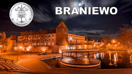
Photo
Where is located Muzeum Ziemi Braniewskiej
Muzeum Ziemi Braniewskiej — local attraction, which is located at Gdańska 19, 14-500 Braniewo, Poland and belongs to the category — museum. Average visitor rating for this place — 4.8 (according to 66 ratings, information from open sources and relevant for 2022).
Exact location — Muzeum Ziemi Braniewskiej, marked on the map with a red marker.
You can get directions to Muzeum Ziemi Braniewskiej on the map from your location.
What else is interesting in Braniewo? You can see all the sights if you go to the city page.
Coordinates
Muzeum Ziemi Braniewskiej, Poland coordinates in decimal format: latitude — 54.3818109629998, longitude — 19.821719425427137. When converted to degrees, minutes, seconds Muzeum Ziemi Braniewskiej has the following coordinates: 54°22′54.52 north latitude and 19°49′18.19 east longitude.
Nearby cities
The largest cities that are located nearby:
- Elblag — 37 km
- Kaliningrad
 (Russia) — 58 km
 - Gdańsk — 76 km
- Olsztyn — 79 km
- Gdynia — 84 km
- Klaipėda
 (Lithuania) — 168 km
 - Torun — 171 km
- Bydgoszcz — 184 km
- Wloclawek — 198 km
- Plock — 203 km
- Koszalin — 237 km
- Bialystok — 261 km
- Kaunas (Lithuania) — 266 km
- Šiauliai (Lithuania) — 276 km
- Łódź — 291 km
- Poznań — 293 km
- Kalisz — 312 km
- Panevėžys (Lithuania) — 320 km
- Radom — 342 km
Distance to the capital
Distance to the capital (Warsaw) is about — 252 km.