
 Gilserberg
Berlin
Bordesholm
Bechtolsheim
Aub
Triptis
Heppenheim
Biblis
Angermünde
Gilserberg
Berlin
Bordesholm
Bechtolsheim
Aub
Triptis
Heppenheim
Biblis
Angermünde
Ferchesarer See on the map, Rathenow, Germany
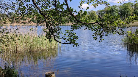
Photo
Where is located Ferchesarer See
Ferchesarer See — local attraction, which is located at no data and belongs to the category — -. Average visitor rating for this place — 4.6 (according to 42 ratings, information from open sources and relevant for 2022).
Exact location — Ferchesarer See, marked on the map with a red marker.
You can get directions to Ferchesarer See on the map from your location.
What else is interesting in Rathenow? You can see all the sights if you go to the city page.
Coordinates
Ferchesarer See, Germany coordinates in decimal format: latitude — 52.65194439692537, longitude — 12.429393411746473. When converted to degrees, minutes, seconds Ferchesarer See has the following coordinates: 52°39′7 north latitude and 12°25′45.82 east longitude.
Nearby cities
The largest cities that are located nearby:
- Potsdam — 54 km
- Berlin — 72 km
- Magdeburg — 72 km
- Wolfsburg — 107 km
- Brunswick — 128 km
- Leipzig — 140 km
- Salzgitter — 145 km
- Rostock — 165 km
- Cottbus — 166 km
- Hildesheim — 169 km
- Szczecin
 (Poland) — 172 km
 - Hanover — 178 km
- Gera — 191 km
- Gorzów Wielkopolski (Poland) — 195 km
- Dresden — 197 km
- Chemnitz — 201 km
- Erfurt — 201 km
- Göttingen — 204 km
- Zielona Gora (Poland) — 228 km
Distance to the capital
Distance to the capital (Berlin) is about — 68 km.