
 Józefów nad Wisłą
Gorzyce Wielkie
Rogówek
Sromowce Niżne
Wyszków County
Kruszewo
Jantar
Sady Górne
Nagoszewo
Józefów nad Wisłą
Gorzyce Wielkie
Rogówek
Sromowce Niżne
Wyszków County
Kruszewo
Jantar
Sady Górne
Nagoszewo
Kościół pw. Św. Jerzego on the map, Ketrzyn, Poland
Photo
Where is located Kościół pw. Św. Jerzego
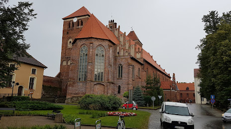
Kościół pw. Św. Jerzego — local attraction, which is located at Zamkowa 5, 11-401 Kętrzyn, Poland and belongs to the category — catholic church. Average visitor rating for this place — 4.5 (according to 148 ratings, information from open sources and relevant for 2022).
Exact location — Kościół pw. Św. Jerzego, marked on the map with a red marker.
You can get directions to Kościół pw. Św. Jerzego on the map from your location.
What else is interesting in Ketrzyn? You can see all the sights if you go to the city page.
Coordinates
Kościół pw. Św. Jerzego, Poland coordinates in decimal format: latitude — 54.07453415285075, longitude — 21.373237725415485. When converted to degrees, minutes, seconds Kościół pw. Św. Jerzego has the following coordinates: 54°4′28.32 north latitude and 21°22′23.66 east longitude.
Nearby cities
The largest cities that are located nearby:
- Olsztyn — 67 km
- Kaliningrad
 (Russia) — 90 km
 - Elblag — 128 km
- Bialystok — 158 km
- Gdańsk — 178 km
- Klaipėda
 (Lithuania) — 180 km
 - Kaunas (Lithuania) — 185 km
- Gdynia — 189 km
- Plock — 203 km
- Torun — 219 km
- Wloclawek — 221 km
- Šiauliai (Lithuania) — 238 km
- Bydgoszcz — 247 km
- Vilnius (Lithuania) — 259 km
- Panevėžys (Lithuania) — 261 km
- Brest
 (Belarus) — 271 km
 - Łódź — 288 km
- Radom — 296 km
- Lublin — 324 km
Distance to the capital
Distance to the capital (Warsaw) is about — 207 km.