
 Gilserberg
Berlin
Bordesholm
Bechtolsheim
Aub
Triptis
Heppenheim
Biblis
Angermünde
Gilserberg
Berlin
Bordesholm
Bechtolsheim
Aub
Triptis
Heppenheim
Biblis
Angermünde
Rodder Maar on the map, Bad Neuenahr-Ahrweiler, Germany
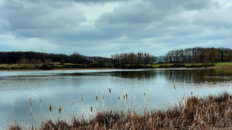
Photo
Where is located Rodder Maar
Rodder Maar — local attraction, which is located at no data and belongs to the category — -. Average visitor rating for this place — 4.7 (according to 80 ratings, information from open sources and relevant for 2022).
Exact location — Rodder Maar, marked on the map with a red marker.
You can get directions to Rodder Maar on the map from your location.
What else is interesting in Bad Neuenahr-Ahrweiler? You can see all the sights if you go to the city page.
Coordinates
Rodder Maar, Germany coordinates in decimal format: latitude — 50.46696549830898, longitude — 7.184993625281412. When converted to degrees, minutes, seconds Rodder Maar has the following coordinates: 50°28′1.08 north latitude and 7°11′5.98 east longitude.
Nearby cities
The largest cities that are located nearby:
- Bonn — 22 km
- Koblenz — 39 km
- Cologne — 45 km
- Bergisch Gladbach — 50 km
- Solingen — 70 km
- Remscheid — 71 km
- Siegen — 73 km
- Aachen — 77 km
- Wuppertal — 79 km
- Neuss — 79 km
- Düsseldorf — 80 km
- Mönchengladbach — 85 km
- Trier — 94 km
- Hagen — 94 km
- Wiesbaden — 95 km
- Krefeld — 96 km
- Mülheim — 98 km
- Mainz — 101 km
- Witten — 101 km
Distance to the capital
Distance to the capital (Berlin) is about — 487 km.