
 Puerto de la Duquesa
La Serna de Iguña
Pumalverde
Puentenansa
La Iglesia
Casar de Periedo
Fuengirola
Renedo de Piélagos
Villabanez
Puerto de la Duquesa
La Serna de Iguña
Pumalverde
Puentenansa
La Iglesia
Casar de Periedo
Fuengirola
Renedo de Piélagos
Villabanez
Cambre - Ruta 2 Rios de Cambre on the map, Culleredo, Spain
Photo
Where is located Cambre - Ruta 2 Rios de Cambre
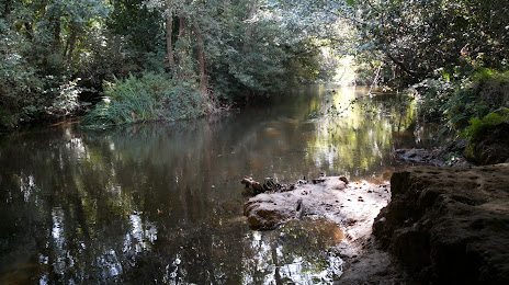
Cambre - Ruta 2 Rios de Cambre — local attraction, which is located at Lugar Campons, 34A, 15181, A Coruña, Spain and belongs to the category — hiking area. Average visitor rating for this place — 4.4 (according to 129 ratings, information from open sources and relevant for 2022).
Exact location — Cambre - Ruta 2 Rios de Cambre, marked on the map with a red marker.
You can get directions to Cambre - Ruta 2 Rios de Cambre on the map from your location.
What else is interesting in Culleredo? You can see all the sights if you go to the city page.
Coordinates
Cambre - Ruta 2 Rios de Cambre, Spain coordinates in decimal format: latitude — 43.2857842342365, longitude — -8.349184274964728. When converted to degrees, minutes, seconds Cambre - Ruta 2 Rios de Cambre has the following coordinates: 43°17′8.82 north latitude and -8°20′57.06 east longitude.
Nearby cities
The largest cities that are located nearby:
- A Coruña — 8 km
- Ourense — 114 km
- Vigo — 119 km
- Braga
 (Portugal) — 193 km
 - Oviedo — 204 km
- Gijón — 220 km
- Porto (Portugal) — 236 km
- León — 242 km
- Coimbra (Portugal) — 341 km
- Salamanca — 343 km
- Valladolid — 353 km
- Santander — 368 km
- Burgos — 397 km
- Bilbao — 439 km
- Vitoria-Gasteiz — 465 km
- Logroño — 493 km
- Alcobendas — 502 km
- Badajoz — 502 km
- Móstoles — 503 km
Distance to the capital
Distance to the capital (Madrid) is about — 500 km.