
 Józefów nad Wisłą
Gorzyce Wielkie
Rogówek
Sromowce Niżne
Wyszków County
Kruszewo
Jantar
Sady Górne
Nagoszewo
Józefów nad Wisłą
Gorzyce Wielkie
Rogówek
Sromowce Niżne
Wyszków County
Kruszewo
Jantar
Sady Górne
Nagoszewo
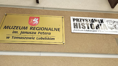
Muzeum Regionalne im. dr. Janusza Petera on the map, Tomaszow Lubelski, Poland
Photo
Where is located Muzeum Regionalne im. dr. Janusza Petera
Muzeum Regionalne im. dr. Janusza Petera — local attraction, which is located at Zamojska 2, 22-600 Tomaszów Lubelski, Poland and belongs to the category — museum. Average visitor rating for this place — 4.6 (according to 18 ratings, information from open sources and relevant for 2022).
Exact location — Muzeum Regionalne im. dr. Janusza Petera, marked on the map with a red marker.
You can get directions to Muzeum Regionalne im. dr. Janusza Petera on the map from your location.
What else is interesting in Tomaszow Lubelski? You can see all the sights if you go to the city page.
Coordinates
Muzeum Regionalne im. dr. Janusza Petera, Poland coordinates in decimal format: latitude — 50.45399223987662, longitude — 23.419888925280883. When converted to degrees, minutes, seconds Muzeum Regionalne im. dr. Janusza Petera has the following coordinates: 50°27′14.37 north latitude and 23°25′11.6 east longitude.
Nearby cities
The largest cities that are located nearby:
- Lublin — 106 km
- Rzeszow — 110 km
- Tarnow — 179 km
- Brest
 (Belarus) — 184 km
 - Radom — 189 km
- Rivne
 (Ukraine) — 200 km
 - Kielce — 200 km
- Uzhhorod (Ukraine) — 218 km
- Košice
 (Slovakia) — 247 km
 - Kraków — 250 km
- Pinsk (Belarus) — 259 km
- Satu Mare
 (Romania) — 296 km
 - Bialystok — 297 km
- Dabrowa Gornicza — 298 km
- Chernivtsi (Ukraine) — 302 km
- Częstochowa — 303 km
- Nyíregyháza
 (Hungary) — 303 km
 - Sosnowiec — 305 km
- Łódź — 307 km
Distance to the capital
Distance to the capital (Warsaw) is about — 259 km.