
 Gilserberg
Berlin
Bordesholm
Bechtolsheim
Aub
Triptis
Heppenheim
Biblis
Angermünde
Gilserberg
Berlin
Bordesholm
Bechtolsheim
Aub
Triptis
Heppenheim
Biblis
Angermünde
Münchner Wald - Kletterwald Vaterstetten on the map, Vaterstetten, Germany
Photo
Where is located Münchner Wald - Kletterwald Vaterstetten
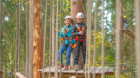
Münchner Wald - Kletterwald Vaterstetten — local attraction, which is located at Ottendichler Str. 1, 85591 Vaterstetten, Germany and belongs to the category — high ropes course. Average visitor rating for this place — 4.4 (according to 874 ratings, information from open sources and relevant for 2022).
Exact location — Münchner Wald - Kletterwald Vaterstetten, marked on the map with a red marker.
You can get directions to Münchner Wald - Kletterwald Vaterstetten on the map from your location.
What else is interesting in Vaterstetten? You can see all the sights if you go to the city page.
Coordinates
Münchner Wald - Kletterwald Vaterstetten, Germany coordinates in decimal format: latitude — 48.11867444814981, longitude — 11.761412225197795. When converted to degrees, minutes, seconds Münchner Wald - Kletterwald Vaterstetten has the following coordinates: 48°7′7.23 north latitude and 11°45′41.08 east longitude.
Nearby cities
The largest cities that are located nearby:
- Munich — 15 km
- Augsburg — 71 km
- Ingolstadt — 77 km
- Innsbruck
 (Austria) — 97 km
 - Salzburg (Austria) — 101 km
- Regensburg — 103 km
- Ulm — 135 km
- Nuremberg — 157 km
- Fürth — 162 km
- Erlangen — 173 km
- Linz (Austria) — 186 km
- Reutlingen — 194 km
- Stuttgart — 203 km
- Pilsen
 (Czech Republic) — 214 km
 - Heilbronn — 218 km
- Würzburg — 227 km
- Trento
 (Italy) — 231 km
 - Pforzheim — 240 km
- Zurich
 (Switzerland) — 256 km
Distance to the capital
Distance to the capital (Berlin) is about — 503 km.