
 Józefów nad Wisłą
Gorzyce Wielkie
Rogówek
Sromowce Niżne
Wyszków County
Kruszewo
Jantar
Sady Górne
Nagoszewo
Józefów nad Wisłą
Gorzyce Wielkie
Rogówek
Sromowce Niżne
Wyszków County
Kruszewo
Jantar
Sady Górne
Nagoszewo
Muzeum-Skansen Regionu Sokołowskiego on the map, Sokołów Podlaski, Poland
Photo
Where is located Muzeum-Skansen Regionu Sokołowskiego
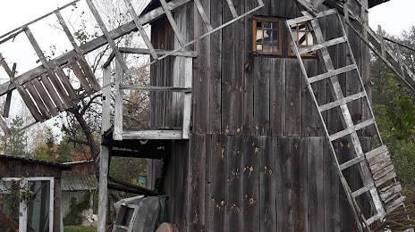
Muzeum-Skansen Regionu Sokołowskiego — local attraction, which is located at Lipowa 64, 08-300 Sokołów Podlaski, Poland and belongs to the category — museum. Average visitor rating for this place — 4.1 (according to 34 ratings, information from open sources and relevant for 2022).
Exact location — Muzeum-Skansen Regionu Sokołowskiego, marked on the map with a red marker.
You can get directions to Muzeum-Skansen Regionu Sokołowskiego on the map from your location.
What else is interesting in Sokołów Podlaski? You can see all the sights if you go to the city page.
Coordinates
Muzeum-Skansen Regionu Sokołowskiego, Poland coordinates in decimal format: latitude — 52.41147492980223, longitude — 22.2341108253529. When converted to degrees, minutes, seconds Muzeum-Skansen Regionu Sokołowskiego has the following coordinates: 52°24′41.31 north latitude and 22°14′2.8 east longitude.
Nearby cities
The largest cities that are located nearby:
- Bialystok — 101 km
- Brest
 (Belarus) — 106 km
 - Lublin — 130 km
- Radom — 135 km
- Plock — 172 km
- Olsztyn — 191 km
- Łódź — 204 km
- Kielce — 205 km
- Wloclawek — 215 km
- Torun — 252 km
- Pinsk (Belarus) — 261 km
- Baranovichi (Belarus) — 262 km
- Rzeszow — 262 km
- Elblag — 267 km
- Kaliningrad
 (Russia) — 278 km
 - Tarnow — 280 km
- Częstochowa — 281 km
- Bydgoszcz — 293 km
- Kalisz — 294 km
Distance to the capital
Distance to the capital (Warsaw) is about — 85 km.