
 Puerto de la Duquesa
La Serna de Iguña
Pumalverde
Puentenansa
La Iglesia
Casar de Periedo
Fuengirola
Renedo de Piélagos
Villabanez
Puerto de la Duquesa
La Serna de Iguña
Pumalverde
Puentenansa
La Iglesia
Casar de Periedo
Fuengirola
Renedo de Piélagos
Villabanez
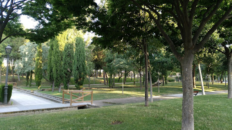
Solidaridad Park (Parque de la Solidaridad) on the map, Getafe, Spain
Photo
Where is located Solidaridad Park (Parque de la Solidaridad)
Solidaridad Park (Parque de la Solidaridad) — local attraction, which is located at Calle Francia, s/n, Fuenlabrada, Madrid, Madrid, Spain and belongs to the category — park. Average visitor rating for this place — 4.4 (according to 3237 ratings, information from open sources and relevant for 2022).
Exact location — Solidaridad Park (Parque de la Solidaridad), marked on the map with a red marker.
You can get directions to Solidaridad Park (Parque de la Solidaridad) on the map from your location.
What else is interesting in Getafe? You can see all the sights if you go to the city page.
Coordinates
Solidaridad Park (Parque de la Solidaridad), Spain coordinates in decimal format: latitude — 40.3008085206207, longitude — -3.757906582672966. When converted to degrees, minutes, seconds Solidaridad Park (Parque de la Solidaridad) has the following coordinates: 40°18′2.91 north latitude and -3°45′28.46 east longitude.
Nearby cities
The largest cities that are located nearby:
- Leganés — 4 km
- Fuenlabrada — 6 km
- Alcorcón — 9 km
- Móstoles — 12 km
- Alcobendas — 27 km
- Torrejón de Ardoz — 27 km
- Alcala de Henares — 36 km
- Valladolid — 170 km
- Salamanca — 177 km
- Albacete — 217 km
- Burgos — 225 km
- Logroño — 260 km
- Zaragoza — 278 km
- Jaén — 280 km
- Córdoba — 283 km
- León — 294 km
- Vitoria-Gasteiz — 295 km
- Valencia — 301 km
- Badajoz — 320 km
Distance to the capital
Distance to the capital (Madrid) is about — 14 km.