
 Puerto de la Duquesa
La Serna de Iguña
Pumalverde
Puentenansa
La Iglesia
Casar de Periedo
Fuengirola
Renedo de Piélagos
Villabanez
Puerto de la Duquesa
La Serna de Iguña
Pumalverde
Puentenansa
La Iglesia
Casar de Periedo
Fuengirola
Renedo de Piélagos
Villabanez
Castell de la Suda on the map, Tortosa, Spain
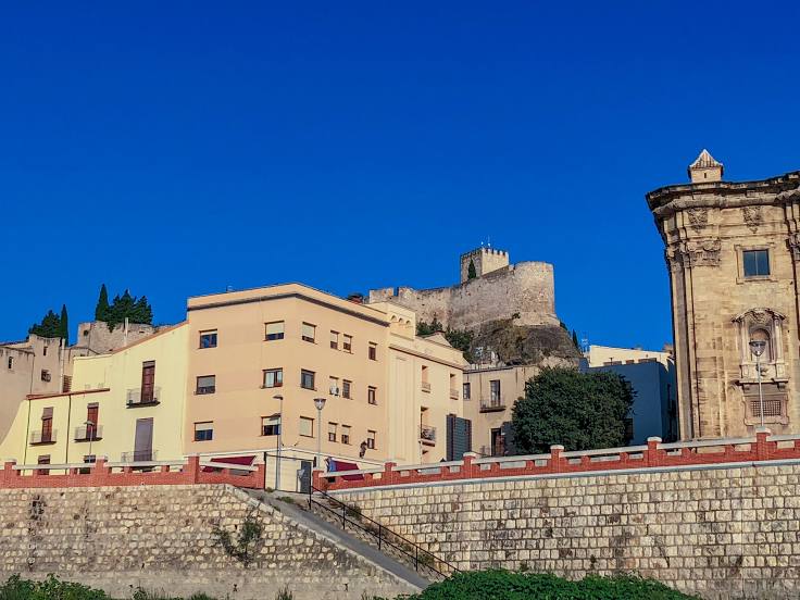
Photo
Where is located Castell de la Suda
Castell de la Suda — local attraction, which is located at Carrer del Castell de la Suda, 43500 Tortosa, Tarragona, Spain and belongs to the category — castle. Average visitor rating for this place — 4.4 (according to 534 ratings, information from open sources and relevant for 2022).
Exact location — Castell de la Suda, marked on the map with a red marker.
You can get directions to Castell de la Suda on the map from your location.
What else is interesting in Tortosa? You can see all the sights if you go to the city page.
Coordinates
Castell de la Suda, Spain coordinates in decimal format: latitude — 40.81531494022392, longitude — 0.5243192249575352. When converted to degrees, minutes, seconds Castell de la Suda has the following coordinates: 40°48′55.13 north latitude and 0°31′27.55 east longitude.
Nearby cities
The largest cities that are located nearby:
- Tarragona — 69 km
- Lleida — 89 km
- L'Hospitalet de Llobregat — 146 km
- Terrassa — 148 km
- Zaragoza — 149 km
- Sabadell — 154 km
- Santa Coloma de Gramenet — 156 km
- Badalona — 159 km
- Valencia — 167 km
- Mataró — 178 km
- Palma — 228 km
- Pamplona — 282 km
- Perpignan
 (France) — 283 km
 - Albacete — 287 km
- Logroño — 303 km
- Toulouse (France) — 317 km
- Alcala de Henares — 329 km
- Torrejón de Ardoz — 339 km
- San Sebastián — 342 km
Distance to the capital
Distance to the capital (Madrid) is about — 360 km.