
 Gilserberg
Berlin
Bordesholm
Bechtolsheim
Aub
Triptis
Heppenheim
Biblis
Angermünde
Gilserberg
Berlin
Bordesholm
Bechtolsheim
Aub
Triptis
Heppenheim
Biblis
Angermünde
Pfaffenberg on the map, Hohenstein-Ernstthal, Germany
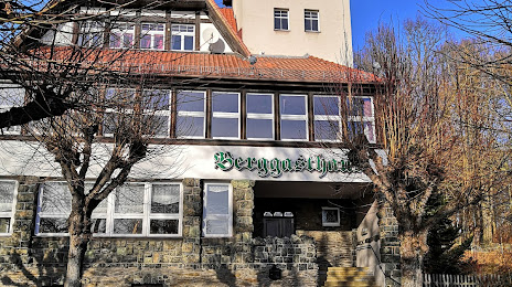
Photo
Where is located Pfaffenberg
Pfaffenberg — local attraction, which is located at 479 m and belongs to the category — -. Average visitor rating for this place — 4.6 (according to 7 ratings, information from open sources and relevant for 2022).
Exact location — Pfaffenberg, marked on the map with a red marker.
You can get directions to Pfaffenberg on the map from your location.
What else is interesting in Hohenstein-Ernstthal? You can see all the sights if you go to the city page.
Coordinates
Pfaffenberg, Germany coordinates in decimal format: latitude — 50.811421136218314, longitude — 12.722541007378998. When converted to degrees, minutes, seconds Pfaffenberg has the following coordinates: 50°48′41.12 north latitude and 12°43′21.15 east longitude.
Nearby cities
The largest cities that are located nearby:
- Chemnitz — 15 km
- Gera — 45 km
- Leipzig — 64 km
- Dresden — 76 km
- Erfurt — 119 km
- Pilsen
 (Czech Republic) — 127 km
 - Prague (Czech Republic) — 146 km
- Cottbus — 153 km
- Magdeburg — 163 km
- Potsdam — 177 km
- Erlangen — 181 km
- Nuremberg — 190 km
- Fürth — 192 km
- Berlin — 193 km
- Regensburg — 203 km
- Göttingen — 209 km
- Brunswick — 220 km
- Salzgitter — 220 km
- Wolfsburg — 221 km
Distance to the capital
Distance to the capital (Berlin) is about — 196 km.