
 Gilserberg
Berlin
Bordesholm
Bechtolsheim
Aub
Triptis
Heppenheim
Biblis
Angermünde
Gilserberg
Berlin
Bordesholm
Bechtolsheim
Aub
Triptis
Heppenheim
Biblis
Angermünde
K1-Willingen on the map, Olsberg, Germany
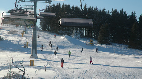
Photo
Where is located K1-Willingen
K1-Willingen — local attraction, which is located at Zur Ruthenaar 3, 34508 Willingen (Upland), Germany and belongs to the category — mountain cable car. Average visitor rating for this place — 4.6 (according to 279 ratings, information from open sources and relevant for 2022).
Exact location — K1-Willingen, marked on the map with a red marker.
You can get directions to K1-Willingen on the map from your location.
What else is interesting in Olsberg? You can see all the sights if you go to the city page.
Coordinates
K1-Willingen, Germany coordinates in decimal format: latitude — 51.291010587132625, longitude — 8.594555425311476. When converted to degrees, minutes, seconds K1-Willingen has the following coordinates: 51°17′27.64 north latitude and 8°35′40.4 east longitude.
Nearby cities
The largest cities that are located nearby:
- Paderborn — 44 km
- Hamm — 58 km
- Siegen — 61 km
- Kassel — 69 km
- Hagen — 70 km
- Dortmund — 72 km
- Bielefeld — 75 km
- Witten — 78 km
- Bochum — 88 km
- Münster — 89 km
- Herne — 90 km
- Remscheid — 92 km
- Recklinghausen — 93 km
- Wuppertal — 93 km
- Gelsenkirchen — 98 km
- Solingen — 99 km
- Göttingen — 101 km
- Essen — 102 km
- Bergisch Gladbach — 102 km
Distance to the capital
Distance to the capital (Berlin) is about — 357 km.