
 Gilserberg
Berlin
Bordesholm
Bechtolsheim
Aub
Triptis
Heppenheim
Biblis
Angermünde
Gilserberg
Berlin
Bordesholm
Bechtolsheim
Aub
Triptis
Heppenheim
Biblis
Angermünde
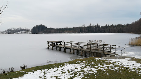
Tinninger See on the map, Prien am Chiemsee, Germany
Photo
Where is located Tinninger See
Tinninger See — local attraction, which is located at no data and belongs to the category — -. Average visitor rating for this place — 4.4 (according to 27 ratings, information from open sources and relevant for 2022).
Exact location — Tinninger See, marked on the map with a red marker.
You can get directions to Tinninger See on the map from your location.
What else is interesting in Prien am Chiemsee? You can see all the sights if you go to the city page.
Coordinates
Tinninger See, Germany coordinates in decimal format: latitude — 47.824713336679515, longitude — 12.20506259676498. When converted to degrees, minutes, seconds Tinninger See has the following coordinates: 47°49′28.97 north latitude and 12°12′18.23 east longitude.
Nearby cities
The largest cities that are located nearby:
- Salzburg
 (Austria) — 53 km
 - Munich — 64 km
- Innsbruck (Austria) — 96 km
- Augsburg — 121 km
- Ingolstadt — 121 km
- Regensburg — 129 km
- Linz (Austria) — 151 km
- Ulm — 184 km
- Nuremberg — 199 km
- Fürth — 204 km
- Erlangen — 214 km
- Trento
 (Italy) — 219 km
 - Pilsen
 (Czech Republic) — 221 km
 - Reutlingen — 241 km
- Graz (Austria) — 248 km
- Stuttgart — 252 km
- Ljubljana
 (Slovenia) — 259 km
 - Vicenza (Italy) — 263 km
- Venice (Italy) — 267 km
Distance to the capital
Distance to the capital (Berlin) is about — 529 km.