
 Józefów nad Wisłą
Gorzyce Wielkie
Rogówek
Sromowce Niżne
Wyszków County
Kruszewo
Jantar
Sady Górne
Nagoszewo
Józefów nad Wisłą
Gorzyce Wielkie
Rogówek
Sromowce Niżne
Wyszków County
Kruszewo
Jantar
Sady Górne
Nagoszewo
Muzeum im. ks. Stanisława Staszica on the map, Hrubieszow, Poland
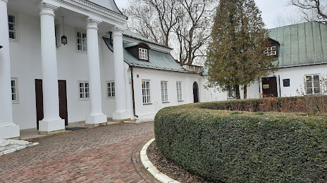
Photo
Where is located Muzeum im. ks. Stanisława Staszica
Muzeum im. ks. Stanisława Staszica — local attraction, which is located at Ulica 3-go Maja 11, 22-500 Hrubieszów, Poland and belongs to the category — museum. Average visitor rating for this place — 4.7 (according to 89 ratings, information from open sources and relevant for 2022).
Exact location — Muzeum im. ks. Stanisława Staszica, marked on the map with a red marker.
You can get directions to Muzeum im. ks. Stanisława Staszica on the map from your location.
What else is interesting in Hrubieszow? You can see all the sights if you go to the city page.
Coordinates
Muzeum im. ks. Stanisława Staszica, Poland coordinates in decimal format: latitude — 50.80409946798883, longitude — 23.887524525293564. When converted to degrees, minutes, seconds Muzeum im. ks. Stanisława Staszica has the following coordinates: 50°48′14.76 north latitude and 23°53′15.09 east longitude.
Nearby cities
The largest cities that are located nearby:
- Lublin — 104 km
- Brest
 (Belarus) — 143 km
 - Rzeszow — 159 km
- Rivne
 (Ukraine) — 167 km
 - Radom — 200 km
- Pinsk (Belarus) — 208 km
- Tarnow — 224 km
- Kielce — 228 km
- Bialystok — 262 km
- Uzhhorod (Ukraine) — 268 km
- Kraków — 292 km
- Baranovichi (Belarus) — 293 km
- Košice
 (Slovakia) — 300 km
 - Chernivtsi (Ukraine) — 316 km
- Łódź — 321 km
- Salihorsk (Belarus) — 328 km
- Częstochowa — 333 km
- Dabrowa Gornicza — 336 km
- Plock — 341 km
Distance to the capital
Distance to the capital (Warsaw) is about — 254 km.