
 Puerto de la Duquesa
La Serna de Iguña
Pumalverde
Puentenansa
La Iglesia
Casar de Periedo
Fuengirola
Renedo de Piélagos
Villabanez
Puerto de la Duquesa
La Serna de Iguña
Pumalverde
Puentenansa
La Iglesia
Casar de Periedo
Fuengirola
Renedo de Piélagos
Villabanez
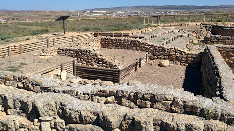
Poblado Ibérico de Alto Chacón. Teruel on the map, Teruel, Spain
Photo
Where is located Poblado Ibérico de Alto Chacón. Teruel
Poblado Ibérico de Alto Chacón. Teruel — local attraction, which is located at 44195 Teruel, Spain and belongs to the category — historical landmark. Average visitor rating for this place — 4.1 (according to 62 ratings, information from open sources and relevant for 2022).
Exact location — Poblado Ibérico de Alto Chacón. Teruel, marked on the map with a red marker.
You can get directions to Poblado Ibérico de Alto Chacón. Teruel on the map from your location.
What else is interesting in Teruel? You can see all the sights if you go to the city page.
Coordinates
Poblado Ibérico de Alto Chacón. Teruel, Spain coordinates in decimal format: latitude — 40.34459258225338, longitude — -1.153021675056851. When converted to degrees, minutes, seconds Poblado Ibérico de Alto Chacón. Teruel has the following coordinates: 40°20′40.53 north latitude and -1°9′10.88 east longitude.
Nearby cities
The largest cities that are located nearby:
- Valencia — 115 km
- Zaragoza — 145 km
- Albacete — 163 km
- Alcala de Henares — 190 km
- Torrejón de Ardoz — 200 km
- Lleida — 200 km
- Tarragona — 214 km
- Alcobendas — 214 km
- Getafe — 221 km
- Leganés — 224 km
- Fuenlabrada — 228 km
- Alcorcón — 229 km
- Móstoles — 233 km
- Logroño — 258 km
- Murcia — 260 km
- Pamplona — 276 km
- L'Hospitalet de Llobregat — 290 km
- Terrassa — 291 km
- Sabadell — 297 km
Distance to the capital
Distance to the capital (Madrid) is about — 216 km.