
 Józefów nad Wisłą
Gorzyce Wielkie
Rogówek
Sromowce Niżne
Wyszków County
Kruszewo
Jantar
Sady Górne
Nagoszewo
Józefów nad Wisłą
Gorzyce Wielkie
Rogówek
Sromowce Niżne
Wyszków County
Kruszewo
Jantar
Sady Górne
Nagoszewo
Samorządowa Instytucja Kultury Park Kulturowy - Ossów - Wrota Bitwy Warszawskiej 1920 roku on the map, Sulejowek, Poland
Photo
Where is located Samorządowa Instytucja Kultury Park Kulturowy - Ossów - Wrota Bitwy Warszawskiej 1920 roku
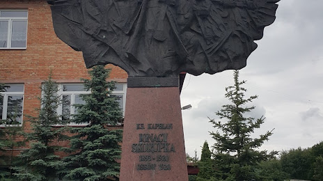
Samorządowa Instytucja Kultury Park Kulturowy - Ossów - Wrota Bitwy Warszawskiej 1920 roku — local attraction, which is located at Matarewicza 148, 05-230 Ossów, Poland and belongs to the category — museum. Average visitor rating for this place — 4.2 (according to 130 ratings, information from open sources and relevant for 2022).
Exact location — Samorządowa Instytucja Kultury Park Kulturowy - Ossów - Wrota Bitwy Warszawskiej 1920 roku, marked on the map with a red marker.
You can get directions to Samorządowa Instytucja Kultury Park Kulturowy - Ossów - Wrota Bitwy Warszawskiej 1920 roku on the map from your location.
What else is interesting in Sulejowek? You can see all the sights if you go to the city page.
Coordinates
Samorządowa Instytucja Kultury Park Kulturowy - Ossów - Wrota Bitwy Warszawskiej 1920 roku, Poland coordinates in decimal format: latitude — 52.26428899843152, longitude — 21.270194893157953. When converted to degrees, minutes, seconds Samorządowa Instytucja Kultury Park Kulturowy - Ossów - Wrota Bitwy Warszawskiej 1920 roku has the following coordinates: 52°15′51.44 north latitude and 21°16′12.7 east longitude.
Nearby cities
The largest cities that are located nearby:
- Radom — 94 km
- Plock — 110 km
- Łódź — 136 km
- Lublin — 143 km
- Wloclawek — 154 km
- Bialystok — 159 km
- Kielce — 160 km
- Brest
 (Belarus) — 168 km
 - Olsztyn — 176 km
- Torun — 197 km
- Częstochowa — 219 km
- Kalisz — 224 km
- Bydgoszcz — 237 km
- Elblag — 243 km
- Tarnow — 249 km
- Rzeszow — 250 km
- Dabrowa Gornicza — 259 km
- Kraków — 259 km
- Sosnowiec — 266 km
Distance to the capital
Distance to the capital (Warsaw) is about — 18 km.