
 Puerto de la Duquesa
La Serna de Iguña
Pumalverde
Puentenansa
La Iglesia
Casar de Periedo
Fuengirola
Renedo de Piélagos
Villabanez
Puerto de la Duquesa
La Serna de Iguña
Pumalverde
Puentenansa
La Iglesia
Casar de Periedo
Fuengirola
Renedo de Piélagos
Villabanez
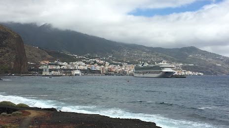
Playa de Bajamar on the map, Santa Cruz de la Palma, Spain
Photo
Where is located Playa de Bajamar
Playa de Bajamar — local attraction, which is located at no data and belongs to the category — -. Average visitor rating for this place — 4.4 (according to 66 ratings, information from open sources and relevant for 2022).
Exact location — Playa de Bajamar, marked on the map with a red marker.
You can get directions to Playa de Bajamar on the map from your location.
What else is interesting in Santa Cruz de la Palma? You can see all the sights if you go to the city page.
Coordinates
Playa de Bajamar, Spain coordinates in decimal format: latitude — 28.67021951537657, longitude — -17.76900813709344. When converted to degrees, minutes, seconds Playa de Bajamar has the following coordinates: 28°40′12.79 north latitude and -17°46′8.43 east longitude.
Nearby cities
The largest cities that are located nearby:
- Santa Cruz de Tenerife — 149 km
- Las Palmas de Gran Canaria — 235 km
- Telde — 241 km
- Agadir
 (Morocco) — 802 km
 - Essaouira (Morocco) — 817 km
- Safi (Morocco) — 892 km
- Marrakesh (Morocco) — 974 km
- El Jadida (Morocco) — 994 km
- Ouarzazate (Morocco) — 1057 km
- Casablanca (Morocco) — 1082 km
- Mohammedia (Morocco) — 1103 km
- Khouribga (Morocco) — 1109 km
- Azilal (Morocco) — 1111 km
- Temara (Morocco) — 1153 km
- Sale (Morocco) — 1168 km
- Nouakchott
 (Mauritania) — 1186 km
 - Kenitra (Morocco) — 1193 km
- Khemisset (Morocco) — 1215 km
- Khenifra (Morocco) — 1217 km
Distance to the capital
Distance to the capital (Madrid) is about — 1830 km.