
 Józefów nad Wisłą
Gorzyce Wielkie
Rogówek
Sromowce Niżne
Wyszków County
Kruszewo
Jantar
Sady Górne
Nagoszewo
Józefów nad Wisłą
Gorzyce Wielkie
Rogówek
Sromowce Niżne
Wyszków County
Kruszewo
Jantar
Sady Górne
Nagoszewo
Wielkopolski National Park on the map, Luboń, Poland
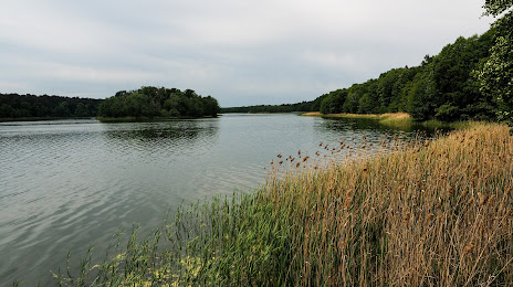
Photo
Where is located Wielkopolski National Park
Wielkopolski National Park — local attraction, which is located at 62-050 Jeziory, Poland and belongs to the category — national park. Average visitor rating for this place — 4.8 (according to 3322 ratings, information from open sources and relevant for 2022).
Exact location — Wielkopolski National Park, marked on the map with a red marker.
You can get directions to Wielkopolski National Park on the map from your location.
What else is interesting in Luboń? You can see all the sights if you go to the city page.
Coordinates
Wielkopolski National Park, Poland coordinates in decimal format: latitude — 52.26867683451845, longitude — 16.797213025347627. When converted to degrees, minutes, seconds Wielkopolski National Park has the following coordinates: 52°16′7.24 north latitude and 16°47′49.97 east longitude.
Nearby cities
The largest cities that are located nearby:
- Poznań — 7 km
- Zielona Gora — 104 km
- Kalisz — 105 km
- Bydgoszcz — 114 km
- Gorzów Wielkopolski — 118 km
- Legnica — 136 km
- Torun — 136 km
- Wrocław — 137 km
- Wloclawek — 151 km
- Walbrzych — 178 km
- Cottbus
 (Germany) — 186 km
 - Łódź — 188 km
- Plock — 192 km
- Szczecin — 194 km
- Opole — 199 km
- Koszalin — 209 km
- Częstochowa — 231 km
- Berlin (Germany) — 234 km
- Berlin (Germany) — 235 km
Distance to the capital
Distance to the capital (Warsaw) is about — 287 km.