
 زفتى
Qesm Hurghada
Gazirat Muhammad
Qesm Nakhl
Om Sabir Village
6th of October City
Cairo Governorate
Qism Sidi Gabir
Ezbet Hussein Salamah
زفتى
Qesm Hurghada
Gazirat Muhammad
Qesm Nakhl
Om Sabir Village
6th of October City
Cairo Governorate
Qism Sidi Gabir
Ezbet Hussein Salamah
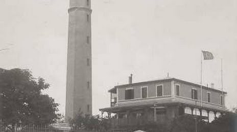
The Lighthouse of Port Said on the map, Port Said, Egypt
Photo
Where is located The Lighthouse of Port Said
The Lighthouse of Port Said — local attraction, which is located at 7877+M93, Port Fouad City, Port Said Governorate, Egypt and belongs to the category — lighthouse. Average visitor rating for this place — 4.4 (according to 766 ratings, information from open sources and relevant for 2022).
Exact location — The Lighthouse of Port Said, marked on the map with a red marker.
You can get directions to The Lighthouse of Port Said on the map from your location.
What else is interesting in Port Said? You can see all the sights if you go to the city page.
Coordinates
The Lighthouse of Port Said, Egypt coordinates in decimal format: latitude — 31.26409391268532, longitude — 32.313347324693694. When converted to degrees, minutes, seconds The Lighthouse of Port Said has the following coordinates: 31°15′50.74 north latitude and 32°18′48.05 east longitude.
Nearby cities
The largest cities that are located nearby:
- Ismailia — 74 km
- Talkha — 90 km
- Zagazig — 108 km
- Banha — 138 km
- Suez — 146 km
- Qalyub — 160 km
- Idku — 189 km
- Ashqelon
 (Israel) — 218 km
 - Alexandria — 225 km
- Ashdod (Israel) — 229 km
- Bat Yam (Israel) — 244 km
- Tel Aviv-Yafo (Israel) — 249 km
- Ramat Gan (Israel) — 253 km
- Netanya (Israel) — 265 km
- Beni Suef — 269 km
- Jerusalem (Israel) — 279 km
- Haifa (Israel) — 302 km
- Tyre
 (Lebanon) — 348 km
 - Amman
 (Jordan) — 350 km
Distance to the capital
Distance to the capital (Cairo) is about — 170 km.