
 Puerto de la Duquesa
La Serna de Iguña
Pumalverde
Puentenansa
La Iglesia
Casar de Periedo
Fuengirola
Renedo de Piélagos
Villabanez
Puerto de la Duquesa
La Serna de Iguña
Pumalverde
Puentenansa
La Iglesia
Casar de Periedo
Fuengirola
Renedo de Piélagos
Villabanez
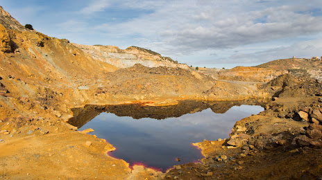
Lago Rojo. Cantera Brunita on the map, La Unión, Spain
Photo
Where is located Lago Rojo. Cantera Brunita
Lago Rojo. Cantera Brunita — local attraction, which is located at 30360 La Unión, Murcia, Spain and belongs to the category — museum. Average visitor rating for this place — 4.4 (according to 85 ratings, information from open sources and relevant for 2022).
Exact location — Lago Rojo. Cantera Brunita, marked on the map with a red marker.
You can get directions to Lago Rojo. Cantera Brunita on the map from your location.
What else is interesting in La Unión? You can see all the sights if you go to the city page.
Coordinates
Lago Rojo. Cantera Brunita, Spain coordinates in decimal format: latitude — 37.6049789308056, longitude — -0.889333375137839. When converted to degrees, minutes, seconds Lago Rojo. Cantera Brunita has the following coordinates: 37°36′17.92 north latitude and -0°53′21.6 east longitude.
Nearby cities
The largest cities that are located nearby:
- Cartagena — 10 km
- Murcia — 46 km
- Almería — 165 km
- Albacete — 173 km
- Valencia — 209 km
- Oran
 (Algeria) — 214 km
 - Granada — 244 km
- Relizane (Algeria) — 245 km
- Jaén — 254 km
- Chlef (Algeria) — 255 km
- Sidi Bel Abbes (Algeria) — 269 km
- Tlemcen (Algeria) — 305 km
- Saida (Algeria) — 321 km
- Nador
 (Morocco) — 329 km
 - Málaga — 329 km
- Oujda (Morocco) — 338 km
- Córdoba — 341 km
- Médéa (Algeria) — 357 km
- Algiers (Algeria) — 361 km
Distance to the capital
Distance to the capital (Madrid) is about — 396 km.