
 Itoshima
Saikai
Izumi
Ichikikushikino
Uruma
Kirishima
Kunisaki
Bungotakada
Gotsu
Itoshima
Saikai
Izumi
Ichikikushikino
Uruma
Kirishima
Kunisaki
Bungotakada
Gotsu
Rokka Forest on the map, Obihiro, Japan
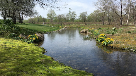
Photo
Where is located Rokka Forest
Rokka Forest — local attraction, which is located at 249-6 Tokiwa, Nakasatsunai, Kasai District, Hokkaido 089-1300, Japan and belongs to the category — garden. Average visitor rating for this place — 4.2 (according to 974 ratings, information from open sources and relevant for 2022).
Exact location — Rokka Forest, marked on the map with a red marker.
You can get directions to Rokka Forest on the map from your location.
What else is interesting in Obihiro? You can see all the sights if you go to the city page.
Coordinates
Rokka Forest, Japan coordinates in decimal format: latitude — 42.692772193544826, longitude — 143.11541362501634. When converted to degrees, minutes, seconds Rokka Forest has the following coordinates: 42°41′33.98 north latitude and 143°6′55.49 east longitude.
Nearby cities
The largest cities that are located nearby:
- Kitami — 112 km
- Asahikawa — 115 km
- Tomakomai — 133 km
- Ebetsu — 135 km
- Sapporo — 150 km
- Otaru — 180 km
- Hakodate — 240 km
- Hachinohe — 303 km
- Aomori — 310 km
- Hirosaki — 344 km
- Morioka — 396 km
- Akita — 441 km
- Yuzhno-Sakhalinsk
 (Russia) — 448 km
 - Ishinomaki — 523 km
- Sakata — 529 km
- Sendai — 553 km
- Yamagata — 573 km
- Fukushima — 618 km
- Koriyama — 660 km