
 Itoshima
Saikai
Izumi
Ichikikushikino
Uruma
Kirishima
Kunisaki
Bungotakada
Gotsu
Itoshima
Saikai
Izumi
Ichikikushikino
Uruma
Kirishima
Kunisaki
Bungotakada
Gotsu
釧路湿原 Kushiro-shitsugen National Park on the map, Kushiro, Japan
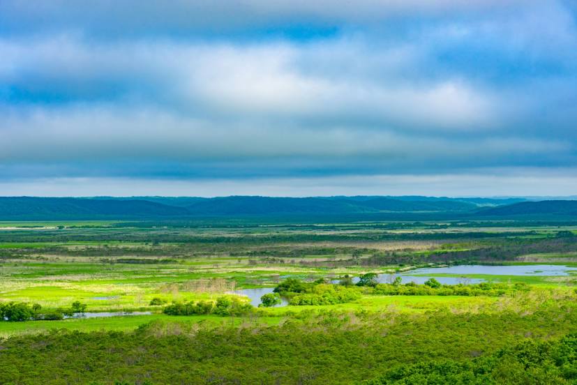
Photo
Where is located 釧路湿原 Kushiro-shitsugen National Park
釧路湿原 Kushiro-shitsugen National Park — local attraction, which is located at 2-2101 Hokuto, Kushiro, Kawakami District, Hokkaido 084-0922, Japan and belongs to the category — national park. Average visitor rating for this place — 4.3 (according to 417 ratings, information from open sources and relevant for 2022).
Exact location — 釧路湿原 Kushiro-shitsugen National Park, marked on the map with a red marker.
You can get directions to 釧路湿原 Kushiro-shitsugen National Park on the map from your location.
What else is interesting in Kushiro? You can see all the sights if you go to the city page.
Coordinates
釧路湿原 Kushiro-shitsugen National Park, Japan coordinates in decimal format: latitude — 43.13897944954275, longitude — 144.4457388250306. When converted to degrees, minutes, seconds 釧路湿原 Kushiro-shitsugen National Park has the following coordinates: 43°8′20.33 north latitude and 144°26′44.66 east longitude.
Nearby cities
The largest cities that are located nearby:
- Obihiro — 96 km
- Kitami — 98 km
- Asahikawa — 183 km
- Tomakomai — 229 km
- Ebetsu — 230 km
- Sapporo — 245 km
- Otaru — 274 km
- Hakodate — 330 km
- Hachinohe — 366 km
- Aomori — 387 km
- Hirosaki — 421 km
- Morioka — 455 km
- Yuzhno-Sakhalinsk
 (Russia) — 457 km
 - Akita — 513 km
- Ishinomaki — 569 km
- Sakata — 596 km
- Sendai — 604 km
- Yamagata — 630 km
- Fukushima — 671 km