Tapiratiba — Cajobi
Tapiratiba — Dois Riachos
Tapiratiba — Pasto Grande
Tapiratiba — Urubá
Tapiratiba — Teodoro Sampaio
Tapiratiba — Miguel Calmon
Tapiratiba — Fortaleza
Tapiratiba — Toritama
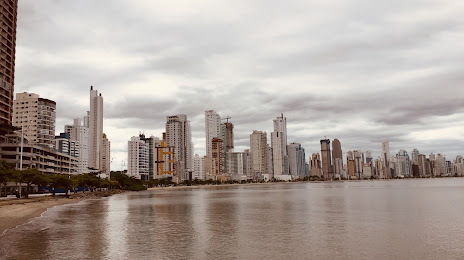
Tapiratiba — Camboriú
Tapiratiba — Marilac
Tapiratiba — Rio Bom
Tapiratiba — Rio Verde de Mato Grosso
Tapiratiba — Torres
Tapiratiba — Seringal Mauritânia
Tapiratiba — Colombo
Tapiratiba — Bandeira
Tapiratiba — Santa Adélia
Tapiratiba — Vitória
Tapiratiba — Montividiu
Itobi
Casa Branca
Aguaí
Mogi-Guaçu
Mogi Guaçu
Mogi Mirim
Mogi Mirim
Jaguariúna
Sousas
Campinas
Valinhos
Viracopos International Airport
Vinhedo
Louveira
Jundiaí
Várzea Paulista
Cajamar
Caieiras
Rochdale
Carapicuiba
Pestana
Taboão da Serra
Embu das Artes
São Lourenço da Serra
Juquitiba
Miracatu
Registro
Cajati
Campina Grande do Sul
Quatro Barras
Piraquara
São José dos Pinhais
Marcelino
Garuva
Joinville
São João do Itaperiú
Tapiratiba — Cajobi
Tapiratiba — Dois Riachos
Tapiratiba — Pasto Grande
Tapiratiba — Urubá
Tapiratiba — Teodoro Sampaio
Tapiratiba — Miguel Calmon
Tapiratiba — Fortaleza
Tapiratiba — Toritama
Tapiratiba — Camboriú
Tapiratiba — Marilac
Tapiratiba — Rio Bom
Tapiratiba — Rio Verde de Mato Grosso
Tapiratiba — Torres
Tapiratiba — Seringal Mauritânia
Tapiratiba — Colombo
Tapiratiba — Bandeira
Tapiratiba — Santa Adélia
Tapiratiba — Vitória
Tapiratiba — Montividiu
Itobi
Casa Branca
Aguaí
Mogi-Guaçu
Mogi Guaçu
Mogi Mirim
Mogi Mirim
Jaguariúna
Sousas
Campinas
Valinhos
Viracopos International Airport
Vinhedo
Louveira
Jundiaí
Várzea Paulista
Cajamar
Caieiras
Rochdale
Carapicuiba
Pestana
Taboão da Serra
Embu das Artes
São Lourenço da Serra
Juquitiba
Miracatu
Registro
Cajati
Campina Grande do Sul
Quatro Barras
Piraquara
São José dos Pinhais
Marcelino
Garuva
Joinville
São João do Itaperiú
Tapiratiba — Barra Velha distance, route on the map
Distance by car
Distance between Tapiratiba, São Paulo, Brazil and Barra Velha, Santa Catarina, Brazil by car is — km, or miles. To travel this distance by car, you need minute, or h.
Route on the map, driving directions
Car route Tapiratiba — Barra Velha was created automatically. The road on the map is shown as a blue line. By moving the markers, you can create a new route through the points you need.
Passing cities through which the car route passes: São José do Rio Pardo, Itobi, Casa Branca, Aguaí, Mogi-Guaçu, Mogi Guaçu, Mogi Mirim, Mogi Mirim, Jaguariúna, Sousas, Campinas, Valinhos, Viracopos International Airport, Vinhedo, Louveira, Jundiaí, Várzea Paulista, Cajamar, Caieiras, Rochdale, Carapicuiba, Pestana, Taboão da Serra, Embu das Artes, São Lourenço da Serra, Juquitiba, Miracatu, Registro, Cajati, Campina Grande do Sul, Quatro Barras, Piraquara, São José dos Pinhais, Marcelino, Garuva, Joinville, São João do Itaperiú.
Distance by plane
If you decide to take a trip Tapiratiba Barra Velha by plane, then you have to fly the distance — 607 km or 376 miles. It is marked on the map with a gray line (between two points in a straight line).
Flight time
Estimated flight time Tapiratiba Barra Velha by plane at cruising speed 750 km / h will be — 48 min.
Direction of movement
Brazil, Tapiratiba — right-hand traffic. Brazil, Barra Velha — right-hand traffic.
Difference in time
Tapiratiba and Barra Velha are in the same time zone. Between them there is no time difference (UTC -3 America/Sao_Paulo).
Interesting Facts
Information on alternative ways to get to your destination.
The length of this distance is about 1.5% of the total length of the equator.
The percentage of the population is clearly shown in the graph:
Tapiratiba — 12,705 (less by 4,960), Barra Velha — 17,665 residents.
The cost of travel
Calculate the cost of the trip yourself using the fuel consumption calculator, changing the data in the table.