
 Toral de los Guzmanes
Granadilla
Castrocalbón
Cerdigo
Benamargosa
Coripe
Hermigua
Villafrechós
Alfambra
Montferri
Felix
Borredà
Mundaka
Mohernando
Piornal
Aielo de Malferit
Villalpando
Lobón
Peñaranda de Duero
Toral de los Guzmanes
Granadilla
Castrocalbón
Cerdigo
Benamargosa
Coripe
Hermigua
Villafrechós
Alfambra
Montferri
Felix
Borredà
Mundaka
Mohernando
Piornal
Aielo de Malferit
Villalpando
Lobón
Peñaranda de Duero
Ponteareas on the map, Spain
Where is located Ponteareas
Exact location — Ponteareas, Pontevedra, Galicia, Spain, marked on the map with a red marker.
Coordinates
Ponteareas, Spain coordinates in decimal format: latitude — 42.1756174, longitude — -8.5064757. When converted to degrees, minutes, seconds Ponteareas has the following coordinates: 42°10′32.22 north latitude and -8°30′23.31 east longitude.
Population
Ponteareas, Pontevedra, Galicia, Spain, according to our data the population is — 23,172 residents, which is about 0% of the total population of the country (Spain).
Comparison of the population on the graph:
Exact time
Time zone for this location Ponteareas — UTC +2 Europe/Madrid. Exact time — wednesday, 5 may 2024 year, 22 h. 54 minutes.
Sunrise and sunset
Ponteareas, sunrise and sunset data for a date — wednesday 15.05.2024.
| Sunrise | Sunset | Day (duration) |
|---|---|---|
| 07:15 -1 minute | 21:44 +1 minute | 14 h. 30 minutes. +2 minutes |
You can control the scale of the map using the auxiliary tools to find out exactly where it is located Ponteareas. When you change the scale of the map, the width of the ruler also changes (in kilometers and miles).
Nearby cities
The largest cities that are located nearby:
- Vigo — 19 km
- Ourense — 55 km
- Braga
 (Portugal) — 70 km
 - Porto (Portugal) — 113 km
- A Coruña — 131 km
- Coimbra (Portugal) — 218 km
- León — 244 km
- Oviedo — 251 km
- Salamanca — 272 km
- Gijón — 273 km
- Valladolid — 318 km
- Amadora (Portugal) — 383 km
- Queluz (Portugal) — 383 km
- Lisbon (Portugal) — 386 km
- Badajoz — 388 km
- Burgos — 393 km
- Santander — 403 km
- Móstoles — 441 km
- Alcorcón — 443 km
Distance to neighboring capitals:
- Lisbon (Portugal) — 388 km
- Andorra la Vella
 (Andorra) — 825 km
 - Rabat
 (Morocco) — 924 km
 - Paris
 (France) — 1124 km
 - Paris (France) — 1124 km
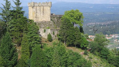
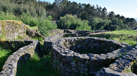
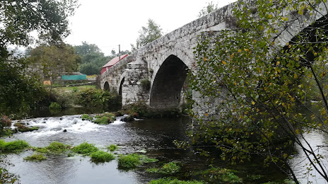
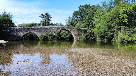
Attractions


Distance to the capital
Distance to the capital (Madrid) is about — 446 km.